Sins is included in the "Tageskarte"
ticket.
Bus 7 is in operation Mo... Fr dep. 7:34 AM at Zug Bahnhof
to Sins
Schulstrasse (End loop).
back: dep. Sins 4:59 PM
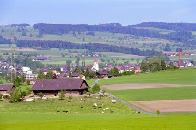
In Sins, up on the hill at the pretty place with church local government
offices, a yellow marker points to the Wanderweg. Passing a newer
residential areas, showing one home prettier then the other, we smoothly
gain altitude.
 Walking on lovely roads we're passing fields and meadows in alternating
environment. Soon to the West the church tower of the little village of
Auw can be seen.
Walking on lovely roads we're passing fields and meadows in alternating
environment. Soon to the West the church tower of the little village of
Auw can be seen.
After crossing the main road in Auw, the road is getting steeper. After
Mariahalden the final ascent begins, for the most part in the forest.
 Finally we hit the Linden tree lined road to the popular Restaurant.
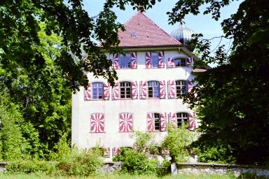
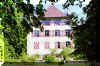
The St. Wendelin chapel is worth a visit, if only to enjoy the view. The castle
nearby is closed for visitors.
Finally we hit the Linden tree lined road to the popular Restaurant.
The St. Wendelin chapel is worth a visit, if only to enjoy the view. The castle
nearby is closed for visitors.
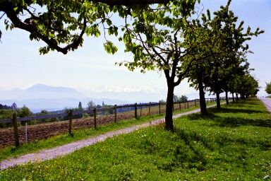
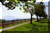 After the well earned rest we proceed towards Hohenrain. Until Unter
Illau the route follows the Bitumen road, with excellent sight into
Mittelland, in the East the Albis chain, then Rigi, to the South the snow capped
Alps.
After the well earned rest we proceed towards Hohenrain. Until Unter
Illau the route follows the Bitumen road, with excellent sight into
Mittelland, in the East the Albis chain, then Rigi, to the South the snow capped
Alps.
After Unter Illau we're crossing again open field and forest, - on my
tour last May I was carefully watched by the grazing cattle. Sometimes the
whole herd would run towards me - for those cowgirls I must have looked
quite handsome.
Soon Hohenrain is welcoming - with the old castle a remarkable sight.
Between the wall and the school area on the Eastern side, a narrow Bitumen
road runs down to Oberebersol. Looking back, the castle hill with vineyard
makes a imposing picture.
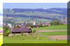
The way by Abtwil to Sins is quite diversified, on minor roads
we're passing open fields and tidy farms. The last part is crossing
Brandwald near Sins