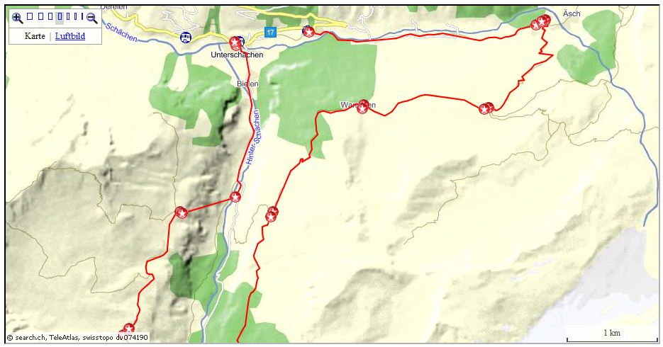
Hikes from the Reuss valley
Lots of hikes can easily be started in this area. Cable cars will bring
you quick and comfortable to a higher starting point.
 | Haldi: A lovely alpine
village that offers both short and extended Walks and hikes. The hike
to Schilt will take you up to quiet alp meadows and to remarkable
lookouts.
Link: https://haldi-uri.ch/ |
| Schaechentaler Hoehenweg:
The
popular track runs from Klausenpass (Balm Klausen) to Eggbergen above
Fluelen, with a couple of cable cars for the return back down into the
valley
- Untere
Balm - Ratzi.
- Ratzi - Eggbergen.
- Balmer Graetli. |
| Klausenpass to Brunnital:
Along Chammliberg - Schaerhorn by Wannelen into Brunnital. |
| Sittlisalp-Aesch: By
Brunnital to the striking Waterfall at Aesch. |
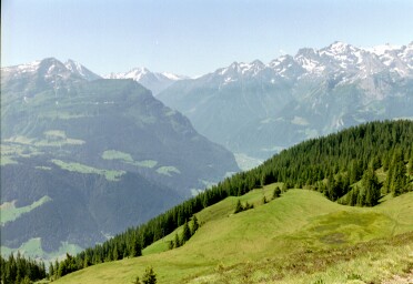
| Eggbergen:
Another favorite offering good walking and hiking tracks. The hike to
Spilauersee will bring us over the 2000 m range and present us with marvelous
views. |
| Chinzig: A trail that will
bring us from Schaechental to Muotathal. |
| Surenenpass: This old mule track
connects Reusstal with the alps on Surenen and Engelberg valley. |
| Maderanertal: Turning left at
Amsteg and climbing some 250 m to Bristen, a beautiful valley opens. A
popular route is by Golzernsee to the old Hotel "SAC
Maderanertal". Extension to Huefihut and -Glacier. |
| Haldi - Gampelen - Schilt - Schattdorf |
km |
hrs |
| Zug-Fluelen |
|
|
| Fluelen-Schattdorf (bus) |
|
|
| Schattdorf-Haldi (cable car) |
|
|
Haldi-Sodberg-Suessberg-Haseli-Gampelen-Schilt-
Lehn-Bol-Schattdorf |
12 |
4.5 |
| Schattdorf-Fluelen (bus) |
|
|
| Fluelen-Zug |
|
|
Leaving the cable car station on a Bitumen road we are passing newer
and older chalets. The ascent is never steep and we have time to enjoy the
pretty setting surrounded by dozens of mountain peaks.
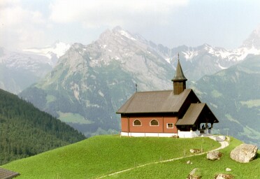
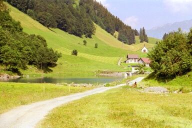
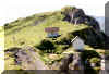
Soon we reach the pretty little church at Sodberg. Catholics will be
surprised to find inside a similar black Madonna as in Einsiedeln.
 |
Church,
Gitschen |
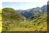
We proceed to Suessberg, to the other side of the valley Teuftal. After
about 50 m of the Marker there is a new sign pointing the track to
Gampelen, Schilt. It's quite a steep ascent now. At first in a almost
straight line up between two fences, later after passing Haseli a forest
track will follow. The bank above Haseli with the beautiful lookout gives
us an excuse for a short rest.
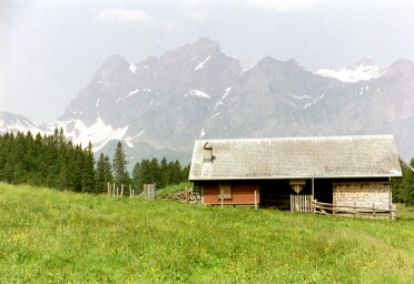
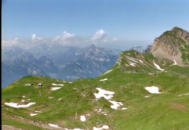
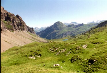
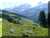
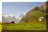
Suddenly we reach a high plateau, alp Gampelen with a couple of alp
huts. A quiet, remote plain. In a bow the alp meadows are protected by
Schwarz Grat, Baelmeten, Hoech Fulen.
 |
On alp Gampelen |
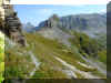
We walk along the plain. A marker to the track for Schilt can be seen
near the last alp hut. 50 m on, a sign marks the forest track to Schilt.
This narrow track is now really fantastic. Passing alp roses, blueberry
bushes, ferns, light forest, flowers, the track follows the flank of
Schwarz Grat on about the same altitude. Walking, we are slowly
recognizing, that we are entering the Reusstal.
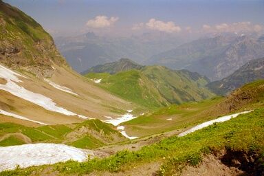
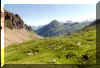
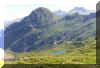
At Schilt the lookout is breathtaking. Far below Altdorf, Schattdorf,
Fluelen. Nearby Urnersee, Gitschen, Rophaien, Fronalpstock.
 |
Near Schilt |
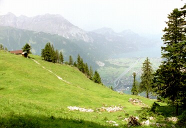
From Schilt we follow the signs for Lehn, Schattdorf. From time to time
we reach a pretty lookout. Soon we are on a fairly new forest road.
We reach a crossing where we have the option for going left along this
service road by Bruederhuus, Aecherli, or by Lehn. Choosing Lehn straight
on, we reach stables and the farmhouse. The Hiking track down by Bol can
be found about 20 m before the little hut on the end of the service road.
walking to the nut tree the white/red/white stick can be seen at the
border of the forest. The track is steep and is zigzagging steep down in a
almost straight line.
Now the church on the hill guides us to the upper part of the village.
From here it's a short way back to where we started.
Back
to Top of page
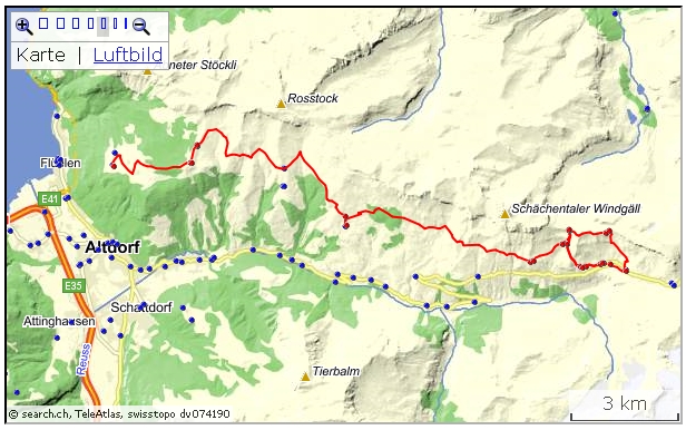
| Schaechentaler Hoehenweg |
| Zug-Fluelen |
Fluelen-Balm (Klausen) Postauto (Urigen-Klausen
only June - Oct)
stops for transfer to cable car stations along the
route |
| Many options for hikes |
| From cable car stations to Fluelen |
| Fluelen-Zug |
 Active
map: Active
map:
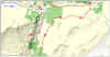
http://map.search.ch/d/zm3mdnmn2
GPS-routes (3 parts)
GPS_Data/GPX-Schaechentaler-HWeg.zip
 For the whole route a time of about 5.5 hrs is estimated. Below three
parts about the area. For the whole route a time of about 5.5 hrs is estimated. Below three
parts about the area.
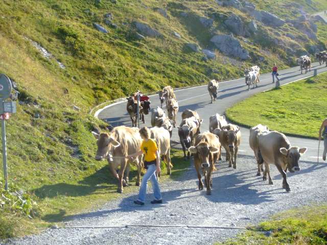
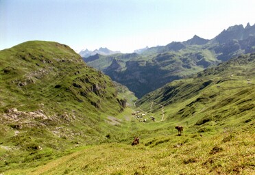
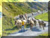
On the picture we see the move of cattle from a higher Alp to one on lower
ground. From the date of the Swiss "Thanksgiving" (mainly a church
matter, no feasting), cattle are removed from the alps, no more cow bells - it's
very quiet then up there.
4 hrs (without detour Ruosalper Chulm 3 h).
Here at the Postauto stop "Untere Balm (Klausen)", most of the
hikers begin the tour towards Eggbergen.
However, if you first need a coffee, stay on the Postauto for the next
stop, „Balm Klausen“, some 800 m on and 50 m higher up.
If you favor rim-tours, you’ll start the walk via “Balmer Graetli”.
The recently improved track “in the sky” is an ideal combination, see below.
 From Untere Balm the first part is on the driveway towards
Heidmannegg. From Untere Balm the first part is on the driveway towards
Heidmannegg.
Shortly after the stables, a path to the right is heading up to Ruosalper
Chulm. Although a detour of about one hour with ascent and descent of 400
m, it allows a view from atop over into Bisistal and Glattalp. Here the
rim-track from Balmer 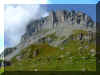 Graetli is merging. Graetli is merging.
A compromise for people not too enthusiastic with walks along abysses, but
interested on a peek down the other side of the mountain.
The normal „Hoehenweg“ runs with little changes in altitude to
Heidmannegg, where the other track from Ruosalper Chulm is merging.
For the time being, the road follows the rock walls of the 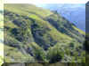 Heidmannegger
Choepf, but soon we’re on a pleasant mountain track. Heidmannegger
Choepf, but soon we’re on a pleasant mountain track.
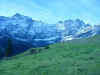
Passing a couple of Alps , again and again we’re enjoying the view into the
Uri mountains: ahead Spannort, Brunnistock, Urirotstock,Gitschen; across the
Schaechental is Chammliberg, Schaerhorn, Ruchen. The rocky escarpment to the right
of the track is part of Schaechentaler Windgaelle area.
After Grotzenegg, where we cross a wooded area, a mountain track is carrying
down to Urigen, actually the begin of the real Klausenpass road, with Postauto
stop and Hotel/Restaurant; the former exchange for the Horses.
A next option for the descent into the valley is Tristel, with the cable car
down to Spirigen/Chipfen.
My goal was some way on, the cable car station Ratzi/Spirigen Post, a
descent of some 100 m. From the Hotel/Restaurant there is an excellent view into
the Uri mountain scenery
Back
to Top of page
3 .5 hrs
From the cable car station and the Restaurant, a forest track is winding up
to the Hoehenweg. It is also part of the local round walk.
Shortly after hitting the driveway, we reach the turnoff for the track to
Chinzig Chulm.
Our route to Eggbergen is proceeding above the woods. After a sharp bend in the road, at
Wiltschi with the sklifts and a cable car for materials and a Restaurant, a
track turns off to the left. It passes the little church and heads for the cable
car station Biel/Rietlig/Bruegg.
We proceed straight on, passing different Alps , many of them producing and
selling Alp cheese.
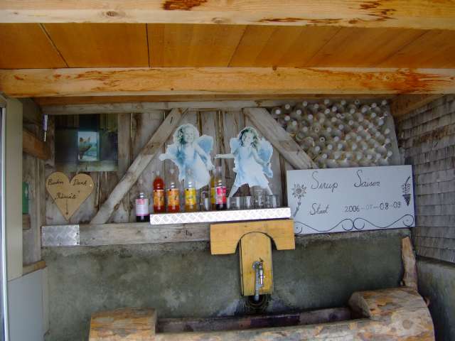
 At Alafur („at the source“) a friendly inhabitant is providing syrup (if
I’m correct, then last summer the consumption was over 300 liter), a big
wooden bench is provided as well. At Alafur („at the source“) a friendly inhabitant is providing syrup (if
I’m correct, then last summer the consumption was over 300 liter), a big
wooden bench is provided as well.
Proceeding along the road, a turnoff for Rietlig is passed. Another cable car
down to Bruegg.
A long wide bend, then a short ascent and we’ve reached Fleschseeli. The
little lake is a very popular target. Shelter, washroom and a kiosk (closed off
season) are provided.
 If we’re choosing the track to the left, rather then the road, we’ll
reach Huenderegg, a marvelous lookout on 1874 m. With the help of the panorama
board the peaks in the nearer or farther distance may be defined. If we’re choosing the track to the left, rather then the road, we’ll
reach Huenderegg, a marvelous lookout on 1874 m. With the help of the panorama
board the peaks in the nearer or farther distance may be defined.
The track goes on, passing woods and pastures and later, after a sharp
descent, we’re again on the gravel road to Eggbergen.
The cable car connects with Fluelen.
From the lower base it’s about 15 Minutes to the Railway station. (For
cable car ride plus walk to the station I would plan 30 Minutes).
Back
to Top of page
Round
tour from/to Balm (Klausen) 3 hrs.
 This
newer mountain track is a pleasure for lovers of rim walks. The track is
well marked and mostly clearly recognizable. Atop, along the rim, the
track is very narrow, but the layout is excellent. Rock climbing is not
needed. On the real rim, on the „Graetli“, the view is fantastic.
Among other views, we see into Bisistal and over to Glattalp. This
newer mountain track is a pleasure for lovers of rim walks. The track is
well marked and mostly clearly recognizable. Atop, along the rim, the
track is very narrow, but the layout is excellent. Rock climbing is not
needed. On the real rim, on the „Graetli“, the view is fantastic.
Among other views, we see into Bisistal and over to Glattalp.
Back
to Top of page
 Interactive
map: Interactive
map:
http://map.search.ch/d/2zinja2yt
GPS-route:
GPS_Data/GPX-KlausenWannelenTrogenUSchachen.zip
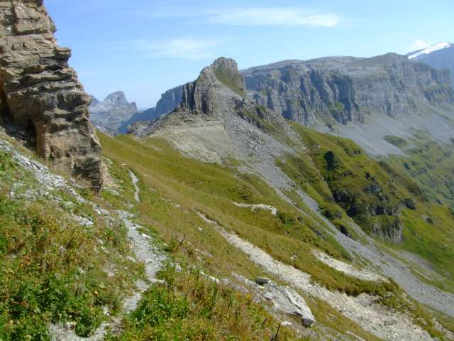
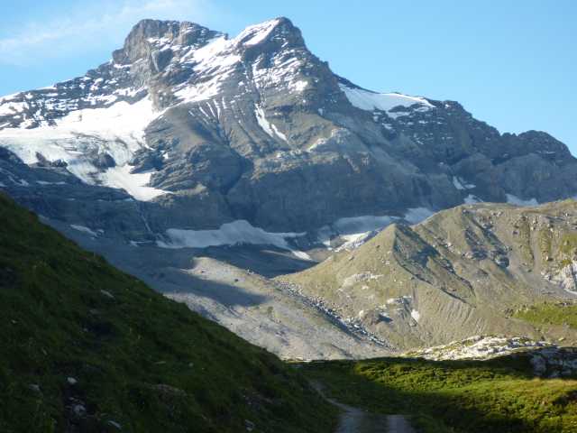
(5 hrs) On the way to Klausenpass, looking at the rocky slopes of Chammliberg and the
Schaerhorn with the white Griess Firn in between, it's a bit surprising to find
a lovely route passing just over there and leading to the alp Wannelen (with
cable car to Ribi
 and the Postauto line).
From Wannelen the scenic track proceeds into deep cut Brunnital. and the Postauto line).
From Wannelen the scenic track proceeds into deep cut Brunnital.
Although there
are spots with breathtaking views, the route shouldn't be too scary for people with a dislike for viewpoints
near an abyss.
The track begins just at the little chapel on the pass summit (1948 m).
The road is ascending moderately to the
Chammli alp on 2050 m.
Along the way 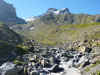 there
are many magnificent views into Schaechental, far down to the Reuss plains, and over to
the other side of the valley with the Schaechentaler Hoehenweg and the rocky Schaechentaler
Windgaelle. The karst landscape is full of deep cuts and stones with polished
surfaces, sometimes showing amazing sculptures. there
are many magnificent views into Schaechental, far down to the Reuss plains, and over to
the other side of the valley with the Schaechentaler Hoehenweg and the rocky Schaechentaler
Windgaelle. The karst landscape is full of deep cuts and stones with polished
surfaces, sometimes showing amazing sculptures.
After
crossing the rubble filled area under Chammliberg and Schaerhorn and a descent into
Oberalp with the tiny lakes, we're on a zigzag track to Niederalp. The
 short
climb to Wannelen is over alpine pasture and again we're provided with excellent
views. short
climb to Wannelen is over alpine pasture and again we're provided with excellent
views.
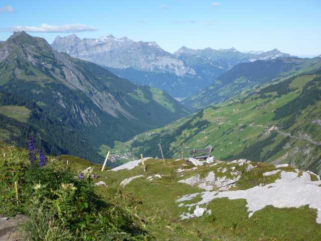
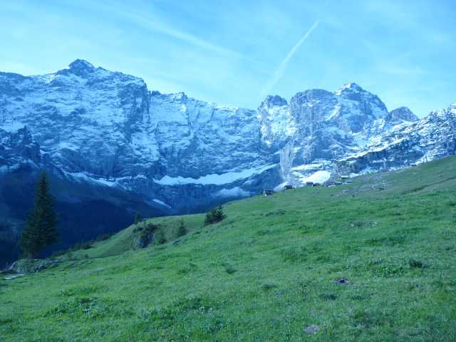
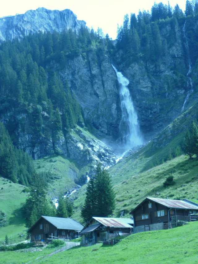
At Oberalp a cable car connects with Aesch. From there an excellent view
to the impressive water fall Staeubae is guaranteed; from Aesch, Ribi (1 hr) or Unterbalm
(1.5 hrs), can be reached, both with Bus stop.
At Wannelen it's probably time for a rest at the small Restaurant. The cable
car down to Ribi allows a convenient short cut of the hike. At Ribi there
is a Bus stop for the Postauto to Fluelen or Klausen-Linthal.
 From
Wannelen the route continues into the Brunni valley to Brunnialp. Along
the path high up along the pastures and through wooded areas we're watching amazed
the alp huts across the valley and at the Sittlis alp (cable car station, distance from
Unterschächen 1.5 km on Bitumen road). From
Wannelen the route continues into the Brunni valley to Brunnialp. Along
the path high up along the pastures and through wooded areas we're watching amazed
the alp huts across the valley and at the Sittlis alp (cable car station, distance from
Unterschächen 1.5 km on Bitumen road).
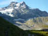
To the southern end of the valley the rock walls of Ruchen and Wingaellen
with patches of snow are quite impressive.
The
road passes Trogen alp (1500 m) with a track down to the valley ground. I
chose the track after alp Nider Lammerbach (1500 m). The road to
Unterschaechen on the right of the Schaechenbach is partly Bitumen, partly gravel.
The hiking track is to the left of the river and merges with the drive way after
the cable car station.
After merging with the river Lammerbach the river along the road is named Hinter
Schaechenbach, the river coming from Klausen is the Vorder Schaechenbach. Both
parts are merging at Unterschaechen to the Schaechenbach. In 2005 it has caused severe
flooding in the Schattdorf area.
 Interactive
map: Interactive
map:
http://map.search.ch/d/jyymwnjnm
GPS-route:
GPS_Data/GPX-Sittlisalp-Wannelen-Aesch.zip
(5 hrs) This is the continuation of the route mentioned above. A cable car makes an easy
climb to Sittlisalp. The walk from Unterschaechen takes about half an hour
on the Bitumen road.
The hiking track starts from the cable car station Vorder Boden (1617 m) with
the small Restaurant. A detour would bring us to Obsaum on 1725 m and a magnificent
view (1 hr return).
Sittlisalp with the large modern cheese dairy (visits
possible after appointment) is half an hour apart, on a flat road passing Laui. The
descent to Brunnialp is on a well marked track. Near the Restaurant at Brunnialp
(1395 m) we're on the crossroads to Unterschaechen and, turning right, up towards Trogenalp.
This part is a comfortable ascent through woods to alps
Nider
Lammerbach and Trogen. After Trogenalp we're on a narrow mountain track climbing
towards Wannelen. Slowly the path changes direction from S/N to W/E; from Brunnital we're
entering Schaechental.
 After Wannelen we're following the same route as above, but at Nideralp we
follow the mountain track to the left, down to alp Aesch. The track is well
marked and the waterfall can be heard quite clearly. Although only when we reach
the pastures at Aesch the Staeubae fall can be seen. After Wannelen we're following the same route as above, but at Nideralp we
follow the mountain track to the left, down to alp Aesch. The track is well
marked and the waterfall can be heard quite clearly. Although only when we reach
the pastures at Aesch the Staeubae fall can be seen.
From Aesch a driveway makes it an easy walk to the Postauto stop at Ribi,
where we pass the cable car station for Wannelen. Unterschaechen can be reached
on a hiking track in less then 20 minutes.
Back
to Top of page
 Active map roundtrip to Fleschseeli Active map roundtrip to Fleschseeli
http://map.search.ch/d/wmxzmq1nw
GPS-route:
GPS_Data/GPX-Eggbergen_Fleschsee.zip
| Eggbergen-Spilaueresee-Eggbergen |
km |
hrs |
| Zug-Fluelen |
|
|
| Fluelen-Eggbergen (cable car) |
|
|
Eggbergen-Fleschsee-Schoen Chulm-Siwfass(pass)-
Spilauersee-Schoen Chulm-Fleschsee-Angelingen-Eggbergen |
13 |
6 |
| Option: Spilauersee-Lidernen Huette SAC-Riemenstalden |
|
|
| Eggbergen-Fluelen (cable car) |
|
|
| Fluelen-Zug |
|
|
From the cable car station we walk between hamlets and chalets.
 |
To the left Haldi
with Schilt and Schwarz Grat |
Soon after the last house we're at a marker which will bring us, after
a couple of steps up onto a pretty track in a light forest.
 |
Pretty scenery,
Uri Rotstock on extreme right |
Proceeding in the direction of Huenderwegg we will make a short detour
up to the nearby hill, rewarding us with a great lookout. On the path to
Flesch Seeli we are passing lovely Alp flora with blueberry's, alp roses,
Erica's.
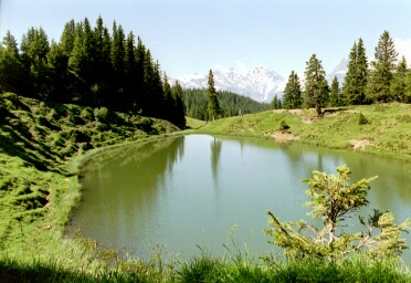
The little lake is prettily embedded in the hills
 |
Flesch See |
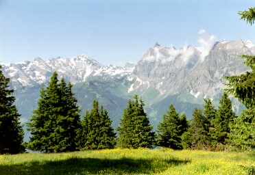
From the lake we're proceeding to Schoen Chulm. The track is
recognizable from afar. The begin of the track is made recognizable by
marked rocks. The ascent is steep but the track is excellent.
On Schoen Chulm we enjoy the fantastic view.
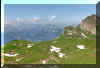 |
Above Schoen Chulm |
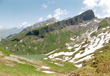
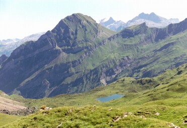
For the pass at Siwfass there is an additional steep ascent, but we
will be rewarded by a gorgeous view. Part of the Spilauer See on the other
side of the pass can now be seen.
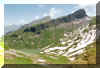 |
Spilauer See |
Back to Eggbergen we choose the road to the right at the Flesch Seeli,
by Angelingen.
Back
to Top of page
| Biel-Chinzig-Hinterthal |
km |
hrs |
| Zug-Fluelen (SBB) |
|
|
Fluelen-Bruegg (Bus)
(Postauto Fluelen-Klausen-Linthal:
reserve seats at Fluelen SBB-Stn) |
|
|
| Bruegg-Biel (cable car) |
|
|
| Biel-Chinzig-Seenalpsee-Seenalp-Liplisbuel-Hinterthal |
12 |
5.5 |
| Hinterthal-Schwyz (Bus) |
|
|
| Schwyz-Zug |
|
|
This route is also marked as "Suworow Wanderung". General
Suworow 200 years ago has crossed Chinzig pass with his Army to get to
Muotathal.
But it's not only history that makes this trail attractive. Since it's a
bit off the more "populated" areas, especially the
Chinzig-Seenalpsee part is a quiet and peaceful region. We start at Biel.
The Postauto has stopped at Bruegg (bridge), that's after Buerglen where
Klausenpass road crosses the "Schaechen" river. The small cable
car has two sections and brings us quickly up onto a beautiful alpine
region.
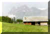
 |
Above Biel |
From the station the trail crosses alp meadows and in steady
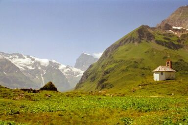
ascent we reach the pretty chapel Bruder Klaus. Nearby is the second
Restaurant (dormitory's, rooms). After about 40 Minutes the steep
flanks of a mountain chain are in front. The trail is clearly visible, in
a steady pace on a excellent track we will be lead to the pass.
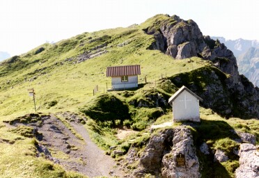
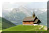
 |
At Chinzig Chulm
with Chapel and shelter |
On the
pass with a little chapel and a board in remembrance of General Suworow we
have fantastic views into mountains and down to Reuss valley.
 |
Turning left we'll pass Seenalptal.
Chinzertal is to the right. |
 |
There are
two tracks to Muotathal. The one to the right follows the Chinzig valley.
We choose the track to the left, by Seenalpsee. After about 200 m we
pass near the Alphut Chinzig. May be you'd like to get some Alp Cheese for
the break at the Seenalpsee. On rocks in the soil we find the direction
of the track: it follows the rocky walls of the
mountain chains to our left with Fulen, Chaiserstock, Bluemberg as the
biggest ones. It's a lovely track over alp meadows with
rocks visible everywhere.
 |
Pretty Seenalpsee |
From the lake the descent to alp Seenalp gets
a bit steeper. At Seenalp you may get tasty "Mutschli", small
Cheese the form of a thick pie. The sizes vary from about 300 gr to 800
gr. Handy to take home for dinner. From
Seenalp down to Huerital there is a gravel road. Perhaps you prefer this
one to the fairly steep trail. Near the valley floor the Seenalp road
merges with the Chinzertal road. When we reach the river we choose the
track to the left (not marked), following the river. The new road runs on
the other side. Soon we cross a marker, pointing up to Seenalp. After
crossing the river (the area is used as parking) the trail follows the
Bitumen road, but soon there follows a track turning off to the left. Later we're
again on the Bitumen road, but as before, there will be a turnoff again
and we'll be on a fairly steep path. At Liplisbuel the track begins
to the right of the Restaurant. The final part above
Hinterthal runs directly
along the wild river. It has cut deep gorges and caves into the rock, a
very amazing stretch as finale furioso. The nearest Bus stop is at
Hinterthal (Muotathal, hintere Bruecke). The main road would lead to
Hoelloch, Pragelpass and Bisistal. Back
to Top of page
Attinghausen and its Freemen have played an important role on the
founding of the Swiss federation. A visit of the ruin and the explanation
boards will give some thoughts concerning history.
The old mule track on this side of the mountain is remarkable. It's a
kind of hollow cobblestone road. With that construction, cattle on the way up to the alps were prevented
from walking off the track. The height difference to Bruesti is about 1000 m and it's
quite a bit steep.
I did the tour from Engelberg to Attinghausen, because the train
connections back to Zug suited me better.
| Surenenpass (Engelberg-Attinghausen) |
hrs |
| Zug-Luzern-Engelberg (train) |
|
Engelberg-cable car station at Hindrist
Option:
shuttle bus between Rail and cable car station in peak season
then cable car Fuerenalp**
www.fuerenalp.ch/ |
1
|
Fuerenalp-Uesser Aebnet-Hohbiel-Staeuber-
Staeuber-Blackenalp(Bielen)-Surenenpass-
Surenenpass-Langschnee-Waldnacht-Hoechiberg-Bruesti |
1
2
2 |
| Bruesti-Attinghausen** (cable car) |
|
| Attinghausen-Altdorf or Flueelen (Bus) |
|
| Altdorf or Flueelen - Zug (train) |
|
**special ticket available for use of both cable car
lines
From Engelberg rail station a Bitumen pedestrian road leads into a
residential area. Then a gravel road turns to the right and after crossing
main road and river Engelberger Aa we're on a convenient hiking track. For
most of the time it follows directly the river, passing the sport area, a
camping area, a Golf driving range. Finally near the end of the Golf range
it enters the woods. Nearby the waterfall is roaring.
The base of the
cable car line with large parking lot is across the river nearby. The
track proceeds on to Herrenrueti: to Surenenpass it's about 4 hrs from
here.
After a remarkable ride over imposing rock walls the Restaurant and top
station on Fuerenalp with breathtaking view is reached.
The trail over alp meadows with fantastic view is accompanied by the
roar of the many creeks and waterfalls in the rock walls across the
valley. Titlis looks a bit different from this side.
Passing Uesser Aebnet (another cable car to the lower Surenen valley
below), at Staeuber finally we reach the scenic waterfall, the main
destination for many hikers.
 For Surenenpass the trail is now climbing: not really steep, but
steady. After a rest on Blackenalp, where delicious alp cheese is being
produced, the steeper ascent for the last part of the way to the pass
follows. For Surenenpass the trail is now climbing: not really steep, but
steady. After a rest on Blackenalp, where delicious alp cheese is being
produced, the steeper ascent for the last part of the way to the pass
follows.
At the summit with the cozy shelter just a few meters back, the Sandwich
containing genuine Blackenalp cheese tastes exceptional.
From above, the track towards Attinghausen looks quite a bit steep. It's
now after mid-July and there are still snow fields to cross.
Although the track is very well marked. At the 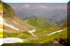 Junction with the appropriate name "Langschnee" (long
snow): Junction with the appropriate name "Langschnee" (long
snow):
The shorter and probably preferred track from Langschnee to Bruesti is
the one to the left along the rim and directly to Bruesti.
I chose the longer route to the right, passing Waldnacht, Seeli, 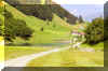 Hoechiberg.
A bit annoying is the fact, that this trail descends lower then the
top station at Bruesti and therefore the altitude difference of some 100 m
has to be regained.
Hoechiberg.
A bit annoying is the fact, that this trail descends lower then the
top station at Bruesti and therefore the altitude difference of some 100 m
has to be regained.
Fortunately nearby a nostalgic
cable car is in operation. It runs up to Bruesti. A note at the house with
the words "Seilwart da" tells that the operator is nearby,
somewhere.
Access to the lake (a regulatory reservoir for the hydro
electric power plant) is not permitted.
At Hoechiberg is the turnoff down to Attinghausen, needed time approximately
2 hours.
 For me the lovely track ended with a drink on the Restaurant terrace.
The Cable car is divided into two sections: the lower sections ends right
at the bus stop. For me the lovely track ended with a drink on the Restaurant terrace.
The Cable car is divided into two sections: the lower sections ends right
at the bus stop.
(Draft)
The small village Golzern (alt. 1400 m) and nearby Lake can be reached
comfortably by Bus (off Erstfel) and cable car.
Starting at Golzern, a popular route is by Staefel (with turn off for
Windgaellenhuette or "SAC Hotel Maderenertal"), then proceeding
for Tritt, there instead of continuing straight on for Huefihuette and
-glacier, returning by Balmeregg/SAC Hotel, Butzensee to Bristen (4.5 h).
|