Interesting for hikers is the fact, that tracks along the
"Bisse's" have 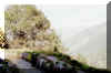 moderate slopes. The Tourist office provides
interesting brochures and information. Especially helpful is the booklet
with Number 2: "les bisses/die suonen" of "Walliser
Wanderwege" (German/French). Publisher VALRANDO: info@valrando.ch.
It contains explanations about the Bisse's, panoramic views, height profiles,
times, Bus stops, Restaurants.
moderate slopes. The Tourist office provides
interesting brochures and information. Especially helpful is the booklet
with Number 2: "les bisses/die suonen" of "Walliser
Wanderwege" (German/French). Publisher VALRANDO: info@valrando.ch.
It contains explanations about the Bisse's, panoramic views, height profiles,
times, Bus stops, Restaurants.
More Informations can be found in: www.nendaz.ch
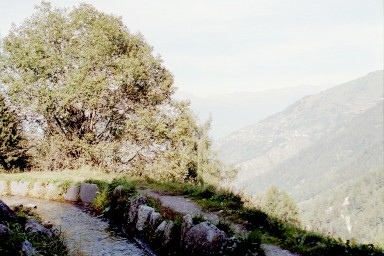
The Bisse's in the region of Nendaz and Veysonnaz draw their water off
the river Printze.
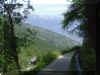
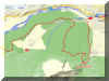
We begin our tour near the lower end of the Bisse vieux (constructed
before 1658), at the Wanderweg
sign some 800 m on the main road from the cable car station towards
Iserable. After a few meters we're on a field track, to the right water murmurs
in its channel.
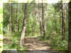
The houses above and below the Bisse are getting fewer and fewer,
finally we're in the forest. Steadily moderately ascending the path runs
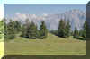
through shady trees, bypassing alp meadows. Here and there we get a view
over to Nendaz, later Veysonnaz.
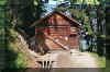
After about two hours we're at the Postauto stop in Lavanthier and the
friendly little Restaurant "Vieux Nendaz".
Back to Nendaz we choose the track along the Bisse du Milieu
(constructed 1700).
From the Restaurant we're on the road to the left down to the river
Printze. Some 200 m after crossing the bridge another Restaurant is
inviting. The track along "our" Bisse is not explicitly
mentioned on the signs (although "Bisse de Vex" is).
A track descends down to the Printze. We cross the river on the
footbridge. The Bisse de Milieu is clearly visible and marked, but no name
is mentioned.
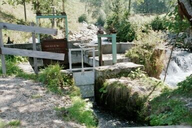
 We'll be passing the places where the water for the Bisse's is being
tapped. Quite interesting.
We'll be passing the places where the water for the Bisse's is being
tapped. Quite interesting.
Along the enjoyable track we'll also pass some creeks crossing the line
of the Bisse. Precautions have been taken to protect the Bisse from
damages by high-water.
After about 1.5 hours we're back in Nendaz.
Built 1865-1876 and in use until 1965, this is a very long Suone. As water source again
it's the
river Printze in the Siviez region in about 1850 m that guarantees a
regular feed.
The Bisse almost surrounds the Dent de Nendaz.
In some parts the channel had to be hewn into rocks, in other parts
abysses were crossed on stilts, in some places stone walls were built. The
sheer length made it necessary also to build three huts for the
caretaker...One is rebuilt at La Bourla: set right over the Bisse.
Although the water channel is not in use anymore, the old track is still
recognizable and in many
places carefully renovated, so we can admire the will and the cleverness of
the people 150 years ago.
I found the tour Nendaz - Tsablo Plan - Le Bourla - Siviez, then
back along the Bisse Vieux (see above) extremely interesting.
Since the latitude of the line is between 1800 and 1700 m we have first to
climb some 500 m.
As start I chose the "Wanderweg" turning off the Bitumen road from Nendaz
Station (the cable car station to La Tracouet) to La Peroua. The narrow path
begins
some 500 m after the Cable car station. Another 500 m and the easy walk
along the Bisse Vieux is over and the fairly steep ascent to Tsable Plans is on.
Partly we're on Bitumen road towards some of the newer Chalets (some still
under construction), partly we're crossing alp meadows. Later we're walking
up on a forest
tracks.
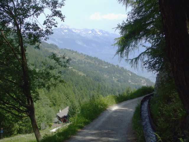
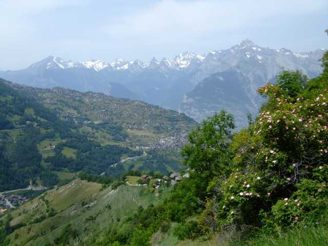
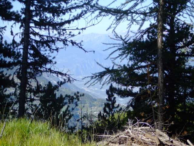
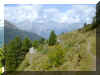
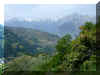
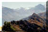
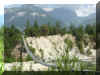
A view into Rhone valley, or across to the Diablerets gives enough
excuses for taking a short break now and then.
Arriving at alp Tsablo Plans the old, dry Bisse de Saxon doesn't impress
much; that will change.
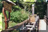
 We're now on a very comfortable track along the old water carrier. Adapted
to the surrounding and available material, the channel consist of ditches,
stone walls, wooden boards.
We're now on a very comfortable track along the old water carrier. Adapted
to the surrounding and available material, the channel consist of ditches,
stone walls, wooden boards.
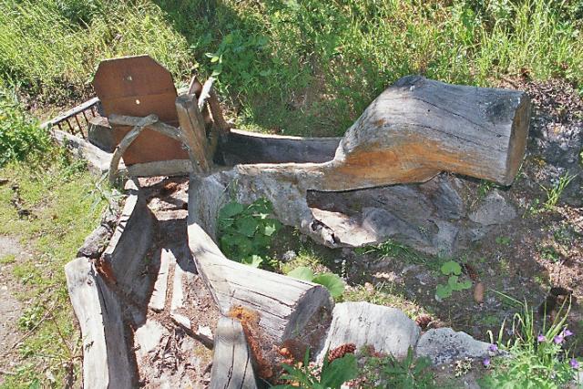
 In some places pipes
can be made out. In some
renovated parts the technology of diverting (switching) the water is
demonstrated; in one place with simple bars, in another a careful cut tree
trunk is used as a kind of water shed ...
In some places pipes
can be made out. In some
renovated parts the technology of diverting (switching) the water is
demonstrated; in one place with simple bars, in another a careful cut tree
trunk is used as a kind of water shed ...
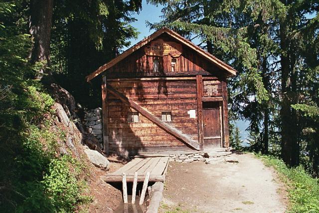
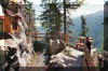
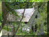
La Bourla with the hut for the overseer makes one think about that guys
job; in horrible weather -and all alone to fix the demolished Bisse as
quick as possible!?
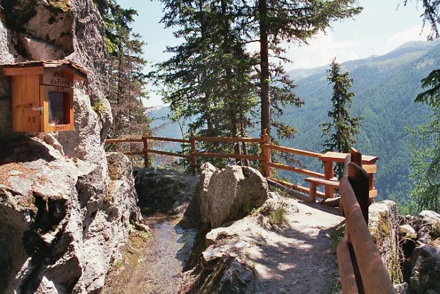
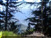
 Later we're passing rocky areas, were the Bisse is cut into rock, or
fenced by a stone wall. The track is now getting narrow, sometimes
trailing under
overhanging boulders.
Later we're passing rocky areas, were the Bisse is cut into rock, or
fenced by a stone wall. The track is now getting narrow, sometimes
trailing under
overhanging boulders.
From Siviez there is track along the Printze. The "entry" to
the Bisse Vieux is some 20 Minutes on the left of the Bitumen road down to
Nendaz.
Walking the "other" way towards Iserable and Mayens de Riddes, from Nendaz to Pra da Dzeu - La Dzora,
one is awarded with a lovely and easy Hike too (but first there is again the ascent to the
altitude of the Bisse).
In La Dzora a longer part of the Bisse is gone. A
track circumventing a critical part of terrain (in June 2005 the road to
Mayens de Riddes and the hiking track were still covered with meters of
debris) will bring you to the last
part in Le Rosey to the Bisse above Mayens de Riddes and Saxon.
The Bisse was constructed in 1862. With an altitude between above 2000
m it's one of the highest, - and especially the first two thirds
especially attractive.
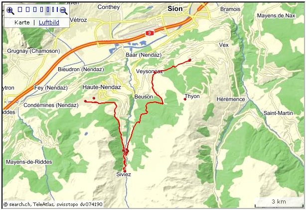
I chose the route:
Siviez (Postauto) - Lac de Cleuson - Thyon (cable
car to Veysonnaz) (5 hrs).
Veysonnaz - (change Beuson) - Nendaz: Postauto
 The
first part is more or less along a ski lift, crossing alpine pasture and
walking in the proximity of brooks and pines.
The
first part is more or less along a ski lift, crossing alpine pasture and
walking in the proximity of brooks and pines.
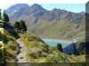
The climb up to the dam of the lake Cleuson is along a zigzag track and
bit steeper then the other sections.
At the dam in the little church there is a board, remembering the eleven
men who died between 1943 and 1950 because of an accident while working on
the construction site.
 The
Bisse is somewhat higher then lake Cleuson.
The
Bisse is somewhat higher then lake Cleuson.
After the first bend of the gravel driveway a narrow track brings us up
directly to the old Bisse. It's now a convenient hiking track, but often
the former purpose is clearly recognizable. The first part, Cleuson to La
Meina, is especially charming, the track itself, the superb view, the
plants...
In the main season a chair lift Siviez-Combatseline is in operation.
Planchouet to Veysonnaz, turnoff to Mayens de l'Ours, 3 hrs
This Bisse (constructed in 1453) draws her water just below Planchouet. A starting point, only in the main season, is the
Bus stop on the road to Siviez (Bifurcation Planchouet).
 From the crossroads we have to descend on the Bitumen road
to the
Bridge, then across the Printze river and ascend on the other side.
From the crossroads we have to descend on the Bitumen road
to the
Bridge, then across the Printze river and ascend on the other side.
A board on the left of the road gives some information. After passing the
two Restaurants along the road the Bisse finally is appearing, sometimes
in a pipe, later in a channel, at other places open, as it used to be.
 The walk along the Bisse de Vex is pleasant, for the most part in the
shade of forest trees. Before entering Veysonnaz, traversing open grass
land, the view stretches over to Nendaz and in the distance the mountains
with the Haut de Cry.
The walk along the Bisse de Vex is pleasant, for the most part in the
shade of forest trees. Before entering Veysonnaz, traversing open grass
land, the view stretches over to Nendaz and in the distance the mountains
with the Haut de Cry.
In Veysonnaz the Bisse trail proceeds passing the cable car station to Thyon
2000, some Restaurants, the Tourist office, then goes on towards Mayens de Sion.
The Bus stop is some 100m from the Tourist office towards
Veysonnaz village.
 The final section, for the most part, is again on a lovely forest
track. Some 800m before the end, we reach the Protestant chapel. After
100m there is a Bus stop and the Bitumen road to Mayens de l'Ours (check
time table).
The final section, for the most part, is again on a lovely forest
track. Some 800m before the end, we reach the Protestant chapel. After
100m there is a Bus stop and the Bitumen road to Mayens de l'Ours (check
time table).
Hint: walking up towards Mayens de l'Ours, the "ancient Bisse
d'Heremence" is close by.
 By Bisse Vieux and Bisse de Vex (5 hrs)
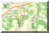
Interactive map: http://map.search.ch/d/mm5mju5mt?x=2784m&y=-896m&z=16
GPS-File: GPS_Data/GPX-Vieux-Vex.zip
An excellent combination, the walk along the two Bisses is easy
walking, mostly in the shade of trees, with many beautiful views.
 Public transport between Nendaz and Veysonnaz:
A change of Buses in "Beuson bif Veysonnaz" is needed;
a 50 m walk and crossing of main road between the two stops.
bif: "bifurcation" = turnoff.
Top of page
This 3 hrs hike provides an insight into the environment and the developments
of the region. In Tsablo Plan, at the old Bisse de Saxon, the system of
collecting and distributing water is explained.
 The track is marked by wooden signs with a pine cone or with the name
of the track.
The track is marked by wooden signs with a pine cone or with the name
of the track.
The first "post" is in the area of the sport track "Vita
parcours". The blue sign for that track is visible right at the main road
from the Tourist office to the cable car station, on the left, when the
main road makes a sharp bend to the right.
After the introduction, there will be 10 more posts with explanations in French,
but Brochures in English and other languages are available from the
Tourist office.
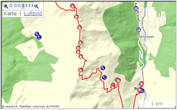
Direct route
For Tracouet, the start for the ascent to Dent de Nendaz, we may use the
cable 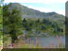 car Nendaz-Tracouet. While ascending, the Bisse de Saxon can be seen
from the windows of the cable car. In these area the water in the Bisse
flows inside
wooded channels.
car Nendaz-Tracouet. While ascending, the Bisse de Saxon can be seen
from the windows of the cable car. In these area the water in the Bisse
flows inside
wooded channels.
From the station atop with the little lake a mountain track runs to the
Dent de Nendaz with a splendid view (90 min return).
 Near the peak is a door to a shaft (300 m vertical) that leads
From Tracouet and Dent de Nendaz are many options for longer or shorter
hikes. Remarkable is the tour over the mountain rim from Dent de Nendaz to
Siviez/Super Nendaz (near Lac Cleuson).
By Plan de la Dzeu
 (La
Peroua - Tracouet 2 hrs).
(La
Peroua - Tracouet 2 hrs).
The
track at La Peroua (Bus stop) is smoothly ascending in the woods. The
Sentier des Pives uses the same route. At Pra da Dzeu, after crossing the
old Bisse de Saxon, we follow the path to the Croix de Jean-Pierre. From
here at the spot with three Christian Crosses, a steeper trail will get us
up to the Tracouet cable car station.
The track to the Dent de Nendaz is clearly marked (90 min return).
Top of page
 Active
map:
Active
map:
http://map.search.ch/d/mvim2e2mz
GPS-route:
GPS_Data/GPX-Siviez-Tracouet.zip
4 hrs
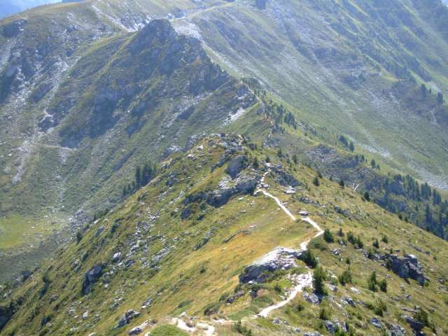
Siviez (Super-Nendaz) - Plan du Fou - Le Basso d'Alou - Pointe de Balavaux
- Dent de Nendaz - Tracouet.
The hike along the rim from Plan du Fou to Den de Nendaz
may be not to everybody's liking: although the track is in very good
condition, there is a bit of rock climbing necessary, and from point 2428
to Basso d'Alou a rope is installed for climbing down hand over hand. The
walk along the rim with sheer drops on both sides may look scary for
somebody "not used to sky walks". As an alternative, there is a
mountain track from Siviez by Grand Alou to Basso d'Alou and just crossing
the rim to Balavaux, Tracouet:
I started the tour at the Postauto stop. (A track would start just
about where 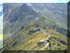 the
"Bisse the Saxon" route is leaving the woods, right above
Siviez). Shortly after passing the Skilift area and sport center, a track
leads to the gravel driveway. This road will bring us up to Plan de Fou,
it's the maintenance road for the Skilifts. There are some shortcuts as
well, some marked, some not.
the
"Bisse the Saxon" route is leaving the woods, right above
Siviez). Shortly after passing the Skilift area and sport center, a track
leads to the gravel driveway. This road will bring us up to Plan de Fou,
it's the maintenance road for the Skilifts. There are some shortcuts as
well, some marked, some not.
At Plan du Fou with a Skilift from Siviez and a cable car from
Balavaux/Prarion 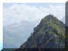 a
grass track brings us to the rim. (There is also a dead end grass road
that ends a few meter under the rim).
a
grass track brings us to the rim. (There is also a dead end grass road
that ends a few meter under the rim).
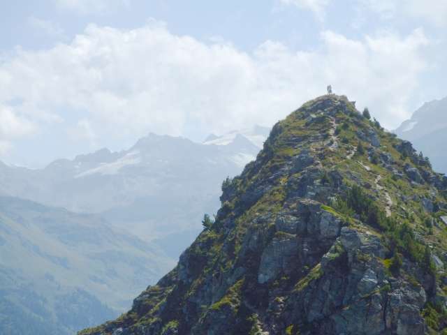
From now on, we're walking in the sky, on a pretty narrow track. Quite
often some rock climbing is needed. Spectacular views are guaranteed. Just
do either walk OR enjoy the view! At the peak on point 2428 a rock
wall has to be descended. The installed rope is pretty welcome. The track
continues, climbing over the peak of Pointe de Balavaux, then finally
reaching the upper part of Dent de Nendaz.
Grand Dixence (www.grande-dixence.ch/)
is a remarkable site. For technically interested visitors a information pavilion
and documentation is available. The inside of the dam can be inspected as
well. Four power plants generate electricity of about 2 GW, three of
them are below surface.
The lake is supplied from a wide area. The water of Lac de Cleuson
 (near Siviez) is
pumped up to lake Dix. Four more pumping plants are in operation. With that, Grand
Dixence is able to produce and sell
high priced peak energy.
(near Siviez) is
pumped up to lake Dix. Four more pumping plants are in operation. With that, Grand
Dixence is able to produce and sell
high priced peak energy.
Thanks to the development of the region, some interesting
hikes in the high mountain region are now easy to get to.
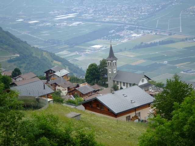
On the way to Grand Dixence we cross the pretty village of  Heremence.
The village is well known for its modern church St Nicolas, a interesting
building in concrete architecture (built 1967/71, Architect W.M.Foerderer).
Heremence.
The village is well known for its modern church St Nicolas, a interesting
building in concrete architecture (built 1967/71, Architect W.M.Foerderer).
A visit of the church is really impressive. The building itself is
remarkable, the ambience inside is special. With sight and sound effects visitors
are transferred into a very peculiar situation.
 Interactive
map:
Interactive
map:
http://map.search.ch/d/tgzmtllzj
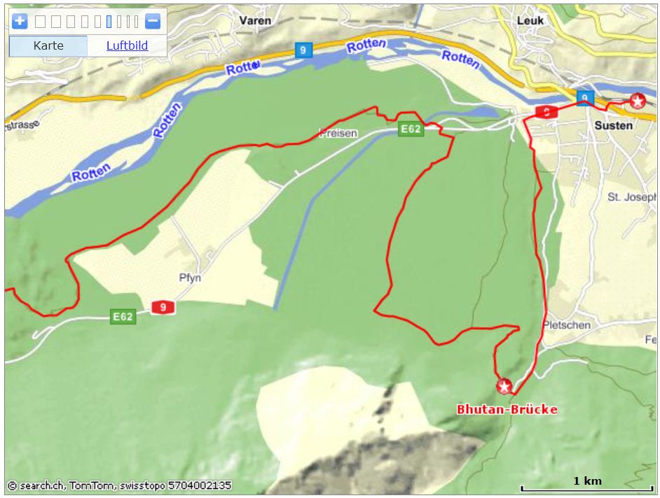
GPS_Data/GPX-Leuk-Bhutan-Pfyn-Sierre.zip
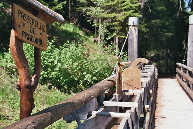
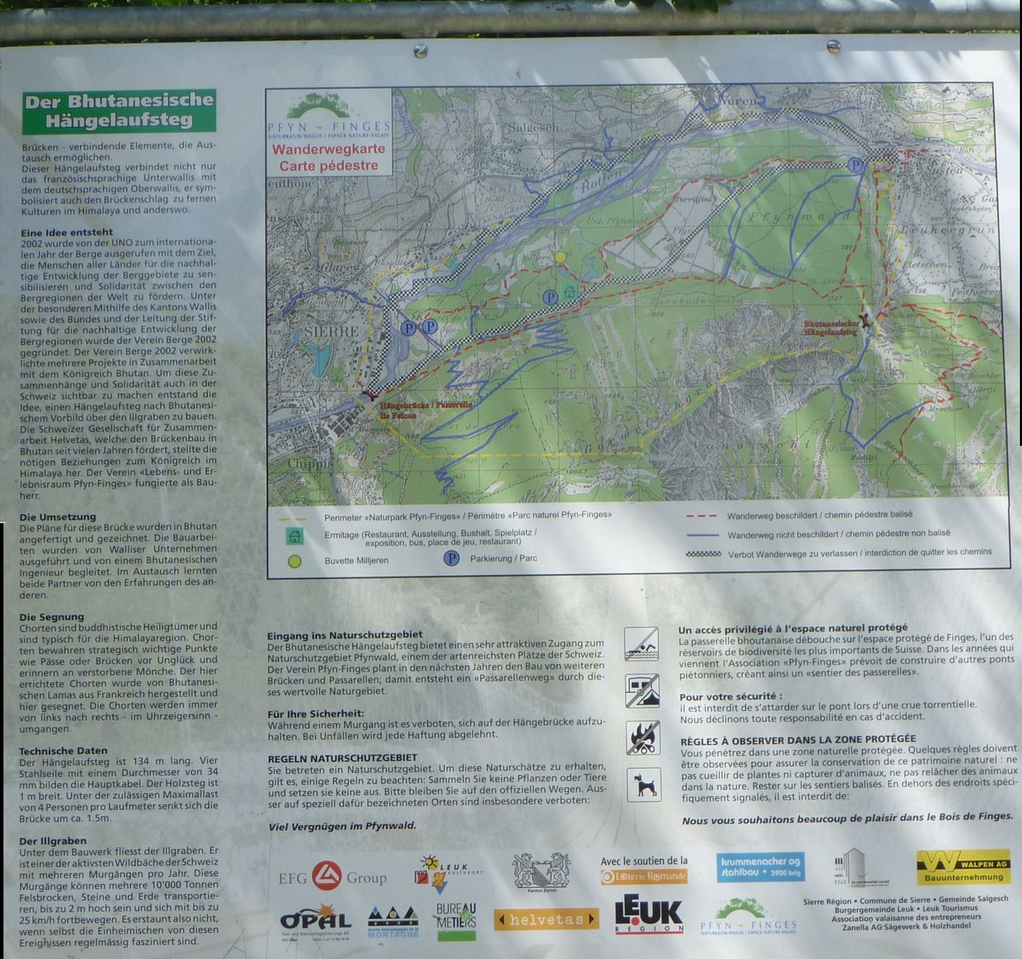
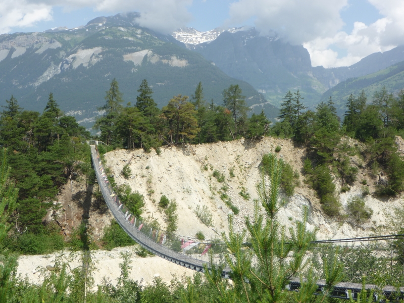
(4.5 hrs). The first part is a detour up to the suspension bridge. 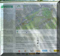 The
name derives from the fact, that the construction of the bridge was a
joint cooperation between Engineers from the kingdom of Bhutan and
Switzerland. It was triggered by the UN's year 2002 of the
mountains.
The
name derives from the fact, that the construction of the bridge was a
joint cooperation between Engineers from the kingdom of Bhutan and
Switzerland. It was triggered by the UN's year 2002 of the
mountains.
From the railway station at Leuk, the route leads to the bridge over
Illgraben (The rift caused by mountain creek "Ill"). Here is
also the Lock from where a Canal is transporting water from the Rhone
river to the power plant in Chippis.
 On both sides of the Illgraben a hiking track reaches
the suspension bridge, so a roundtrip just to the bridge is an option (2.5
hrs). Choosing the climb on the Eastern side, we're first on
Bitumen road, later proceeding on a comfortable gravel road and passing
the soccer field area, later a picnic area under the pin trees. Going on,
the
On both sides of the Illgraben a hiking track reaches
the suspension bridge, so a roundtrip just to the bridge is an option (2.5
hrs). Choosing the climb on the Eastern side, we're first on
Bitumen road, later proceeding on a comfortable gravel road and passing
the soccer field area, later a picnic area under the pin trees. Going on,
the 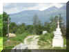 Camping area "Bella Tola" is situated to the left. Finally,
the suspension bridge is reached, some 200 m above Leuk / Susten. A
Christian cross and a small Stupa and prayer flags on the bridge are
reminding the cooperation of the Swiss and Bhutan engineers. Crossing the
bridge gives an impressiv view over the lower part of the Illgraben.
Camping area "Bella Tola" is situated to the left. Finally,
the suspension bridge is reached, some 200 m above Leuk / Susten. A
Christian cross and a small Stupa and prayer flags on the bridge are
reminding the cooperation of the Swiss and Bhutan engineers. Crossing the
bridge gives an impressiv view over the lower part of the Illgraben.
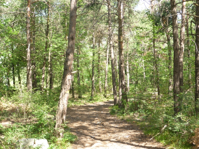
 For the Pfynwald tour a direkt track from the western side of the
Bhutan bridge is provided, by way of "obere Abschlacht". It's a pleasant
walk on a gravel road in a pine tree forest. For more information about
the nature park, see: http://www.pfyn-finges.ch/
For the Pfynwald tour a direkt track from the western side of the
Bhutan bridge is provided, by way of "obere Abschlacht". It's a pleasant
walk on a gravel road in a pine tree forest. For more information about
the nature park, see: http://www.pfyn-finges.ch/
After reaching the Rhone valley plains again, the main road has to be
crossed (be careful). A track is at first sight hardly visible and a sign is
missing. But entering the shrub for just a step or two, the yellow sign in 30m distance
to the NW can be seen, and a track as well.
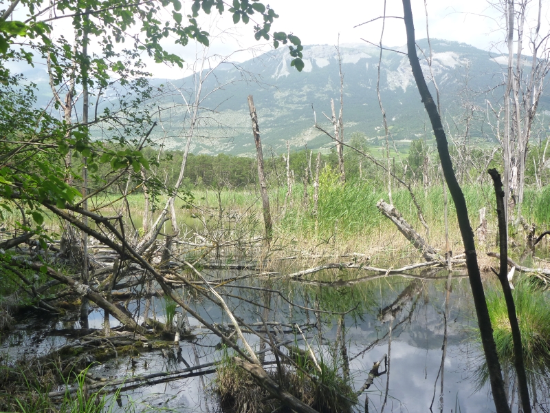
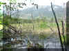 For the most part the terrain is flat. A
creek or water channel may be on the way, the pine tree providing shade. Where the path is on the fringe of the pines it might get pretty
hot in the summer time. There are also some small lakes embedded in the
greenery.
For the most part the terrain is flat. A
creek or water channel may be on the way, the pine tree providing shade. Where the path is on the fringe of the pines it might get pretty
hot in the summer time. There are also some small lakes embedded in the
greenery.
About 200 m after having managed the mainroad we're crossing a large
water-channel which is feeding the generators of the Aluminum plant in Chippis.
After a lot of "dealings" (and selling off the electric power
plants) and cost for electricity for
Aluminum-production have become too high (keywords: Alusuisse, Blocher/Ebner/Marchionne,
Alcan, Rio Tinto, Apollo) the power plant is now property of FMV (main
shareholder is Canton Wallis).
The last part, towards Sierre is in a hilly area. The Pfynwald track
ends at a Bus stop "Parc de Finges" near the camping ground;
walking time to Sierre railway station is about 45 Min.