Michaelskreuz
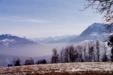
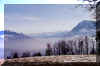
Across Zugersee a hill is dividing the Luzern area with the river Reuss from the Zugersee. Atop stands the
lovely chapel of Michaelskreuz. The lookout is marvelous and the whole
area offers a bunch of walking tracks.
| Michaelskreuz |
km |
Std. |
| Zug-Rotkreuz (train) |
|
|
Rotkreuz-Chüntwil (Kuentwil)-Bachtalen-Grossweid-
Mittler
Sonderi-Michaelskreuz |
4 |
1.5 |
Michaelskreuz-Obertal-Steintobel-Chüntwil
Option: Michaelskreuz-Obertal-Meierskappel |
4
2.5 |
1.2
0.6 |
| Rotkreuz-Zug (train) |
|
|
From Rotkreuz Railway Station or the public parking area South
of the church (6 hr parking) we proceed along Kuentwilerstrasse. We're in a attractive residential area.
Soon the Bitumen road becomes a field track leading into the forest.
In a steady climb we reach Mittler Sonderi. Here the sight suddenly opens
towards the Reusstal. The Autobahn can not only be seen, it can be heard
as well.
The road is still ascending along the hill side, till after hardly 20 Minutes we reach the
hamlet Michaelskreuz (Restaurant, Lodging, "sleeping
on straw").
 |
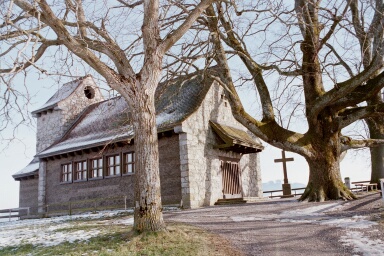
On Michaelskreuz |
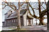 |
Chapel |
For the way back we choose the route by Obertal, then through the
Steintobel gorge. This part is especially lovely. For the first part the
track runs above the creek that has cut its bed far below, later we're
walking just beside it's clear water.
After Obertal there is also the choice for Meierskappel (www.meierskappel.ch).
A pretty village, there is a Bus service to Rotkreuz.
In summertime especially attractive is a walk in combination with the
ship (e.g. from/to Buonas).
|