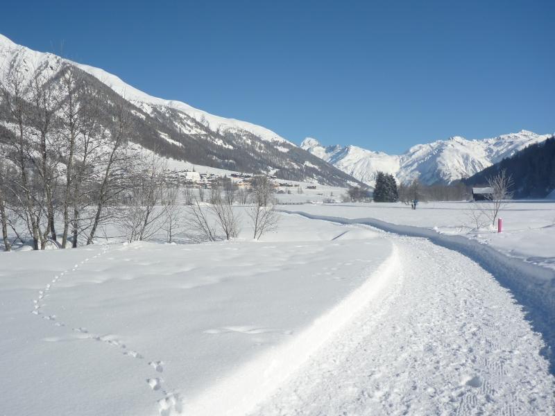
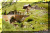
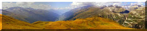
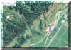
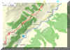
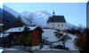
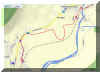
Goms
Separated by just by a tunnel, this amazing region can be reached by
train in about 20 Minutes from Realp, or 35 Min from Andermatt. A popular region for cross
country skiers in Winter, it has a lot to offer for Hikers in the summer.
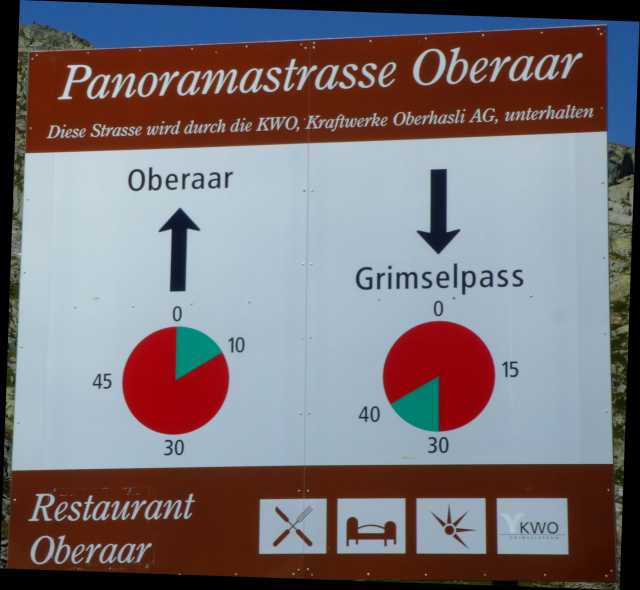
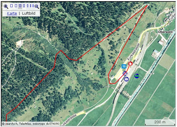
Oberwald as the uppermost village is on the other side of Furkapass,
which runs from Realp by Furkapass and Gletsch. Gletsch is the turnoff for
Grimselpass, leading to Haslital and Meiringen.
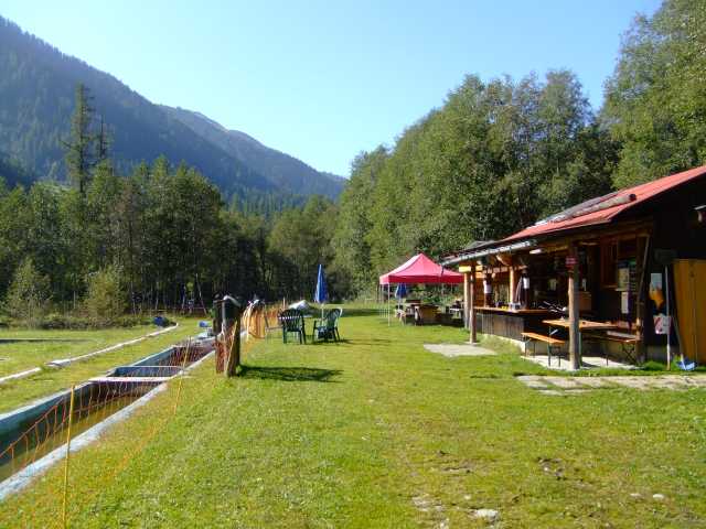
During summer, combinations with the renovated Steam train "Dampfbahn Furka
Bergstrecke" may give a special touch to some of the Hikes. There are
stops at Tiefenbach, Furka DFB, Muttbach, Gletsch and Oberwald.
Book
in German "Walliser Totentanz"
top of page
Nufenenpass:
The track of Strada alta Bedretto (Strada degli alpi) continues to
Griespass (and to Italy) or by Nufenenpass over into Goms valley in Valais.
The new excellent pass for motor traffic was opened in 1969. With an altitude
of about 2500 m Nufenen it is the highest public main road in Switzerland.
While the Furka train tunnel (Real-Oberwald) was being built, a connection
with Bedretto valley was considered and some constructive adaptations
where carried out, but Plans are now archived.
Griespass:
From Griespass, the old mule track crosses over to Italy's Forazza
valley and on to Domodossola (Bus Ritale/IT near lake Lagi di Morasco
to "Domo"). On the first Sunday in August a big
"Saeumerfest" is celebrated on the Italien side of the pass with a lot of drinking, eating and
having fun.
Since both crossings are close, the track notes cover both.
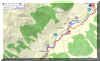
| Ulrichen-Gries See-All'Acqua |
Std. |
| Zug-Goeschenen-Andermatt-Ulrichen (train) |
|
| Ulrichen-Loch-Bodmer bridge-Ladstafel-lake
Lake-point 2520-Capane di Corno-Alpe di
Cuino-All'Acqua |
4.5
2.5
|
All'Acqua-Airolo (bus)
Airolo-Zug (train) |
|
After Ulrichen railway station the trail is running some 50 m
West of the Nufenen pass road. Pedestrian are even presented with their
own roofed wooden bridge.
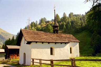
At "Loch" (hole) the pass road has to be crossed. The little
church  Saint Anna with a beautiful wooded ceiling and a remarkable
altarpiece should be visited. Not only the church, the whole environment
with the old houses and their unique staircases is well worth a short
visit.
Saint Anna with a beautiful wooded ceiling and a remarkable
altarpiece should be visited. Not only the church, the whole environment
with the old houses and their unique staircases is well worth a short
visit.
Shortly afterwards the trail ascends on the left side of the pass road.
The first 150 m are Bitumen, then we're on a lovely hiking trail,
sometimes far off the noisy pass road, then again close by. Sometimes the
road has to be crossed, but we're always on our own track.
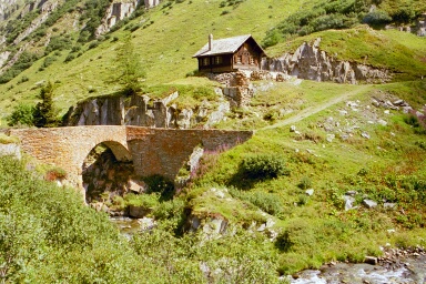
Quite interesting and a bit adventurous is finally the crossing of the
river Aegina on Bodmer bridge, a fairly new suspension bridge. The river below is quite wild.
 At Ladstafel there is another bridge,
the old stone bow bridge "Ladsteg" (1761). High
up the dam of Gries lake is visible and to the left a Christian cross.
That's about where we're heading. At Ladstafel there is another bridge,
the old stone bow bridge "Ladsteg" (1761). High
up the dam of Gries lake is visible and to the left a Christian cross.
That's about where we're heading.
After crossing the pass road the track passes the alp hut to the right
(cheese produced here is being sold). It's getting very steep now. At
first the track is generally leading towards Nufenen pass, but later more
towards the dam. After a while we hit the driveway.
To the left the road is leading to Nufenenpass, to the right to the
parking near the dam.
Following the road to the parking, the last part can be reached by a
ragged track, climbing some rocks. By using the much longer driveway a
more comfortable ascent is possible. The crown of the dam may be crossed.
Having lunch above the lake we're in a unfamiliar surrounding:
across 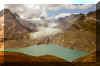 the glacier "Griesgletscher" with
Blinnenhorn, across the
lake the Italian/Swiss border. To Griespass it's about 30 Minutes on the very
good visible path over the rubble. the glacier "Griesgletscher" with
Blinnenhorn, across the
lake the Italian/Swiss border. To Griespass it's about 30 Minutes on the very
good visible path over the rubble.
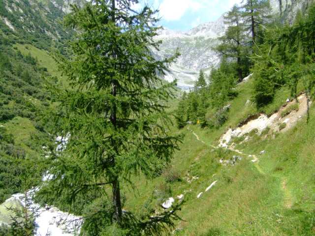
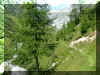
The trail into Bedretto valley runs in the cut of the Val Corno with 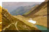 the impressive glacier scenery: the lake, squeezed in by Nufenenhorn and
the snow- and ice covered flanks of the mountain range, which is building
the border between Italy and Switzerland. The track is running on a little
moraine, rests of snow are still filling some deeper hollows.
the impressive glacier scenery: the lake, squeezed in by Nufenenhorn and
the snow- and ice covered flanks of the mountain range, which is building
the border between Italy and Switzerland. The track is running on a little
moraine, rests of snow are still filling some deeper hollows.
The descent from Corno
hut (Capanna Corno Gries) is a bit ragged, partly washed out. From
here another trail runs to San Giacomo and over the pass with the same
name into Italian Formazza valley, where also Griespass is leading.
 The way
to Airolo may be shortened by using the Postauto. Near Alpe di Cruina there
is a bus stop for the Line Ulrichen-Nufenen-Airolo. (Dep. towards Airolo:
4:15, 6:23 PM, Jun 23 - Sep 30, schedule 2007). The way
to Airolo may be shortened by using the Postauto. Near Alpe di Cruina there
is a bus stop for the Line Ulrichen-Nufenen-Airolo. (Dep. towards Airolo:
4:15, 6:23 PM, Jun 23 - Sep 30, schedule 2007).
For hikers the trail runs along the pass road.
Later on we're on a narrow track right in the blueberry and juniper
shrubs. For a short stretch the track is even ascending, a bit irritating
for the tired hiker, but it's worth the trouble. Soon we're enjoying the
shade of trees and then we're on the driveway over to All' Acqua with bus
stop and Restaurant. (Dep. towards Airolo: 4:20, 4:35; 5:25,
6:25 PM, June -
Sep, schedule 2007).
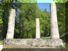
The modern, pretty chapel is worth a visit.
|
A former chapel was rebuilt in 1465, after destruction. The
present chapel was built between 1683 and 1686, after destruction of
that other chapel.
Land was a present of the local family Riedmatten. Additional
financial support was received from Italian partners across the
border.
The statue "Saint Anna with Daughter Maria and baby son
Jesus" was built by sculptor Regli, after a picture with
Saint Anna has been burnt and destroyed by French and Swiss soldiers
during the Helvetic (1799). The small statue (Nepomuk) to the left
in the font of the nave used to be at Ladsteg (the stone bridge at
Ladstafel),
together with a small Ex Voto picture. |
top of page
Grimsel pass was another important part of the mule track net. It
connected Goms in the Valais with the Bern Haslital.
| Oberwald-Grimselpass |
hrs |
| Zug-Goeschenen-Andermatt-Realp-Oberwald (train) |
|
Oberwald-St.Niklaus-Baerfel-Hotel Rhonequelle-
Sattelti-Nassbode-Chruezegge-Totensee-Grimselpass |
3.5 |
Grimselpass-Oberwald (Postauto)
Oberwald-Realp-Andermatt-Goeschenen-Zug (train) |
|
Postauto:
check! only in operation during
Summer months!
As for some other routes a "Zuschlag" (surcharge) is applied,
because the route is a pure tourist route, not used for regional trafic.
With a free ticket (like "GA") the charge Grimsel Pass-Gletsch-Oberwald is Fr. 8.-- (2008).
 The logical start for the tour should accordingly be
Obergesteln. I chose Oberwald. Although I had to modify my plans a bit,
because the track by Grimselbode was closed (repair, falling rocks). So I
chose the somewhat longer route by Hohflue. The logical start for the tour should accordingly be
Obergesteln. I chose Oberwald. Although I had to modify my plans a bit,
because the track by Grimselbode was closed (repair, falling rocks). So I
chose the somewhat longer route by Hohflue.
The section Oberwald to Hotel Rhonequelle is marked as a Snow - shoe track
in winter!
The start of the Grimselbode - track is some 100 m from the
church in direction of the railway station. The beginning for our tour is shortly after Rhone bridge. Both tracks are clearly
marked and of course there are lots of other fantastic trails as well.
The first part is flat and crosses woods with lightly dispersed Larch
pines. Then it proceeds along the young Rhone river which deposits here
lots of sand and gravel. Still in the flat, we cross the Goneri river, then
the Rhone. Now the track gets steeper, but for sweating it's either too
early still, or not steep enough. The little Chapel Saint Niklaus gives an
excuse for a short rest, and it's a lovely lookout.
The climb on the forest track goes on and soon we're in the Garden of
the Hotel Rhonequelle with its fountain.
The path continues some 50 m over at the other side of the pass road.
It is now a drive way (closed to public motor traffic). This
pleasant road will continue almost to the top of the pass.
Shortly after the stables at Sattetli we're at the merger with the
track coming up from Obergesteln. Sometime later we're at another merger with the
track for Jostsee lake and Sidelhorn, or Rundsee - Bidmer to Obergesteln.
 From this merger, at about 2200 m altitude, the last part of the track will be
partly over polished rock plates on the way over to Totensee and our goal, the
Grimsel pass summit. From this merger, at about 2200 m altitude, the last part of the track will be
partly over polished rock plates on the way over to Totensee and our goal, the
Grimsel pass summit.
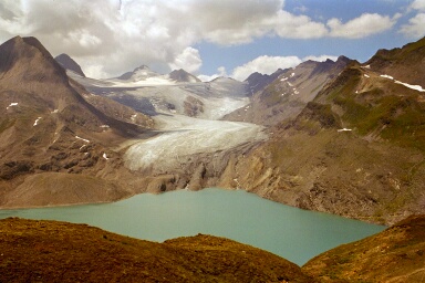
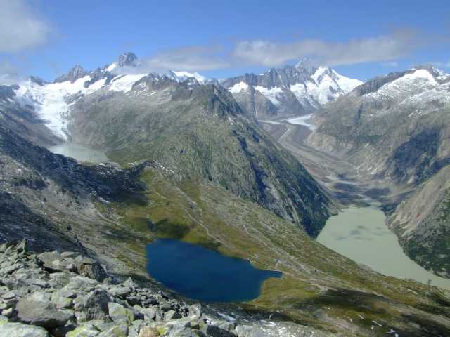
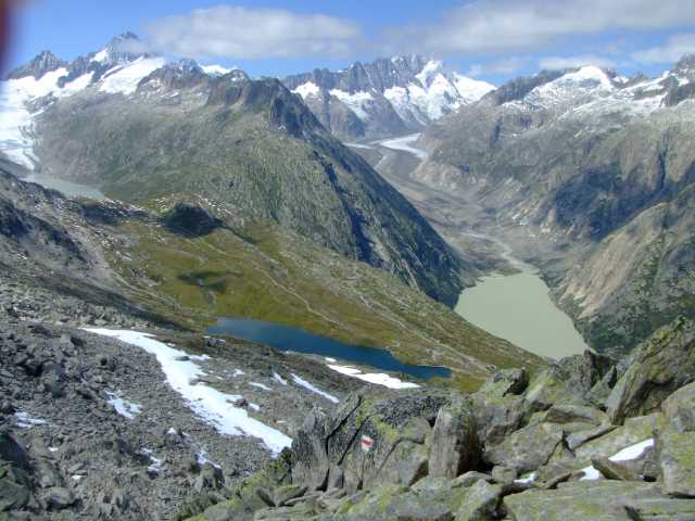
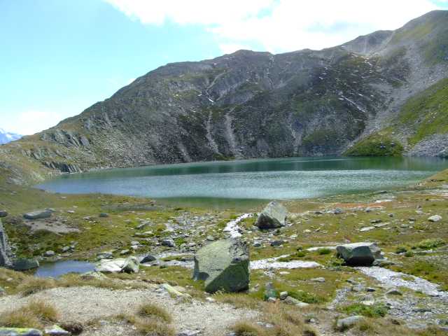
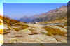
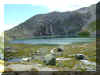
Totensee
For the name of the lake (lake of the dead) is again Napoleon
partly responsible: In the fight of 1799 against the Austrians, the
many dead soldiers of both sides have been buried in this lake. |
top of page
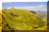
The climb to the nearby Sidelhorn is quite popular, perhaps especially
for the visitors driving up Grimselpass road.
The hike is neither difficult, nor dangerous, - but very bumpy. Particularly
the upper part consists of a bunch of broken rocks. Lots of
"Steimanndli" (stones stacked on top of each other) give some
hints of a reasonable way.
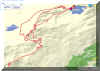
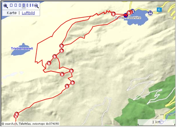
Active map:
map.search.ch/d/jq5yti1mz?x=-1096m&y=-1248m
GPS-File:
GPS_Data/GPX-Grimsel-Sidelh-Jost-Obergesteln.zip
| Grimsel Pass-Sidelhorn-Obergesteln |
hrs |
Zug-Luzern-Meiringen (SBB, ZB)
Meiringen-Grimselpass (Postauto) |
|
Grimsel "Alpenroesli"-(Husegghuette)-Sidelhorn-
(Triebseelicke)-Jostsee-Ze Seewe- Gaemschfax-Ragarten-Gadestatt-Obergesteln |
6 |
| Obergesteln-Goeschenen-Zug (MGB, SBB) |
|
Postauto:
Check! only in operation during
Summer months!
As for some other routes a "Zuschlag" (surcharge) is applied,
because the route is a pure tourist route, not used for regional traffic.
With a free ticket (like "GA") the charge Meiringen-Grimsel Pass
is Fr. 8.-- (2008).
Instead
of using the marked track by Husegghuette, I chose the direct line by
"Sidelini" (On the active map, thats the southern track). That is, instead of following the Oberaar road for
200 m, I turned left. An unmarked track is clearly visible. After 1000 m,
a rocky area of Sidelhorn is circumvented on the 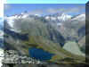 left.
Following on the left side of the cleft the real climb begins now. It's a bit tiring, crawling
over all those rocks. Reaching the saddle at 2640 m, the other track coming up from Husegghuette
is being met. The "official" track is perhaps the better
choice! The last 100 m to the top bring more and bigger rocks, but finally we're
atop. What a view! left.
Following on the left side of the cleft the real climb begins now. It's a bit tiring, crawling
over all those rocks. Reaching the saddle at 2640 m, the other track coming up from Husegghuette
is being met. The "official" track is perhaps the better
choice! The last 100 m to the top bring more and bigger rocks, but finally we're
atop. What a view!
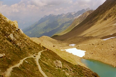
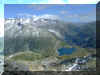
Above pictures:
Lower photo: Blue Triebtensee (=opaque lake) and brownish Oberaar- and Grimsel
lakes (such water is often named "glacier milk").
To the West, behind Oberaarsee and Oberaargletscher is Finsteraarhorn, the
Peak behind the end of Grimselsee is Schreckhorn, with the Finsteraar and
Lauteraar glacier merging into Unteraar glacier and running towards
Grimselsee.
Upper photo: To the North-East the white Galenstock (with the cloud), Rhonegletscher and blue
Totensee.
 The
descent towards Triebseelicke is mainly over big boulders. At the merger
with the track coming up from Triebtensee (Pt 2689), I turned left down the
rocky rubble towards Jostsee (on the "active map" the northern
track). The
descent towards Triebseelicke is mainly over big boulders. At the merger
with the track coming up from Triebtensee (Pt 2689), I turned left down the
rocky rubble towards Jostsee (on the "active map" the northern
track).
Reaching the alp meadows and turning towards to the right, Jostsee is
reached after a few Minutes.
 The
walk to the little lakes, Ze Seewe (=at the lakes), follows for a good
part a narrow grass track (under it is water pipe) along a hill. After the
rocky decline some recuperation for the poor legs. The
walk to the little lakes, Ze Seewe (=at the lakes), follows for a good
part a narrow grass track (under it is water pipe) along a hill. After the
rocky decline some recuperation for the poor legs.
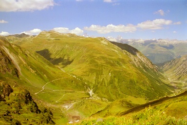
Then the descent is coming. First to Gaemschfax and then, steeper
still, to Gadestatt.
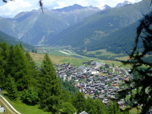
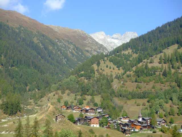
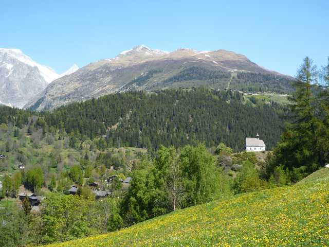
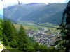
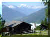
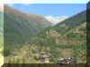
Obergesteln is one of those lovely hamlets in the Goms valley, with
the church in the center, surrounded by sun burnt wooden homes and stables.
Usually, on the hillside there are dams as protection against avalanches,
some times with a chapel right in the most important spot.
top of page
Furka is the second highest pass in Switzerland that is open for Motor
traffic. From the summit the lookout Bidmer can be reached comfortably.
| Furkapass-Bidmer-Furkapass (easy short tour) |
hrs |
Furkapass-Muttgletscher-Bidmer
Bidmer-Muttgletscher-Furkapass (same way back) |
1
1 |
| Furkapass - Oberwald |
hrs |
Zug-Goeschenen-Andermatt (train)
Andermatt- Furkapass (Postauto) |
|
Furkapass-Muttgletscher-Bidmer-Bidmersee-Lenges-
Gand-Tole-(Hungerberg)-Gere-Oberwald |
4 |
| Oberwald-Andermatt-Goeschenen-Zug (train) |
|
Postauto: check! usually only in operation during
Summer months!
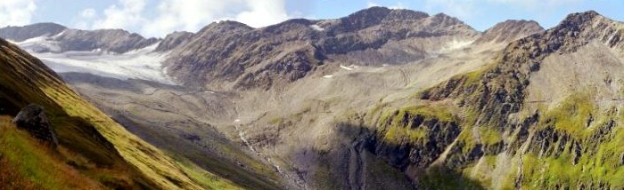
Two remarkable trails are leading down into Goms and Oberwald. Up 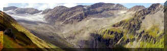 to
Mutt glacier both routes are identical and for the most part clearly
visible from the summit: At first to the glacier, then in a wide bow
across the valley along the slope of Taellistock over to the alp
meadows. to
Mutt glacier both routes are identical and for the most part clearly
visible from the summit: At first to the glacier, then in a wide bow
across the valley along the slope of Taellistock over to the alp
meadows.
At the begin the driveway, slightly ascending, runs along the valley of
Muttbach and to the lower end of the glacier. Deep below the tracks of the
mountain railway can be seen.
After crossing the glacier rubbles and some creeks we're on the other side
of Muttbach. We ignore the turn off for the mountain track towards
Taellistock and on to Taelligrat, Hungerberg, Gere, Oberwald.
Proceeding on the flat and comfortable route we're traversing a region
with falling rocks. Some tunnels give some additional security. Shortly
after leaving this zone, now on a Grass track, again a path turnoff. It is
connecting with the above mentioned Taelligrat route, this time on the
other side of Taellistock.
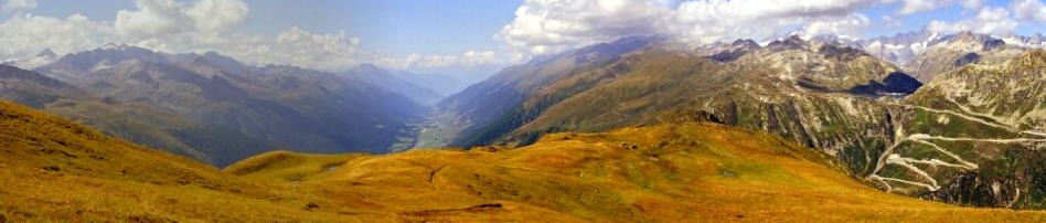
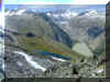
We are tempted by the little hill with the altitude detail "2510
m". 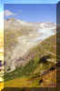 The short climb is rewarding: in a impressive way
Rhonegletscher,
Grimsel and Totensee are presented. Deep below is Gletsch with the
departure point Furka Dampfbahn, the Hotel and the two pass roads.
Belvedere with the entrance into Rhone glacier seems to be The short climb is rewarding: in a impressive way
Rhonegletscher,
Grimsel and Totensee are presented. Deep below is Gletsch with the
departure point Furka Dampfbahn, the Hotel and the two pass roads.
Belvedere with the entrance into Rhone glacier seems to be
touchable.
 |
For the Short tour, this is the point for return and probably for lunch
too.
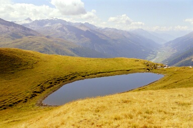
The trail to Oberwald passes near the three little Bidmer lakes. One 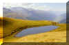 thing
is obvious: the descent is steep and the track not always clearly visible.
Getting lost is not possible: way below, somewhat to the left the
continuation of the track can clearly be seen. thing
is obvious: the descent is steep and the track not always clearly visible.
Getting lost is not possible: way below, somewhat to the left the
continuation of the track can clearly be seen.
After crossing of the Alps Gand and Tole we reach the small driveway 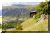 down to Gere. Some bends later we're at the turnoff for the mountain
station and Restaurant of Hungerberg (the board reads 10 Minutes). From
there Oberwald can be reached by chairlift, saving some 50 Minutes of, now
again a rather steep, descent.
down to Gere. Some bends later we're at the turnoff for the mountain
station and Restaurant of Hungerberg (the board reads 10 Minutes). From
there Oberwald can be reached by chairlift, saving some 50 Minutes of, now
again a rather steep, descent.
top of page
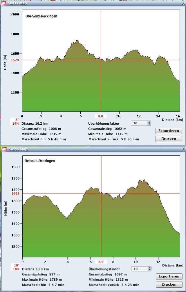
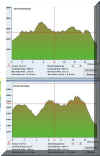 Profiles Profiles
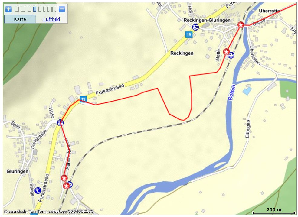
Oberwald-Reckingen
and
Bellwald-Reckingen
 Interactive map: Interactive map:
map.search.ch/d/2iynjlizt
GPS-route:
GPS_Data/GPX-Oberwald-Reckingen2.zip
| Oberwald-Reckingen |
hrs |
| Zug-Goeschenen-Andermatt-Realp-Oberwald (SBB, MGB) |
|
Oberwald-Hostette-Birchi-Gadestatt-Gafene-
Nessel-Obergadme-
Bine-Loeuwene-Riti-Wiler-Loewwigadme-Reckingen |
5.0 |
| Reckingen-Andermatt-Goeschenen-Zug (MGB, SBB) |
|
For this lovely track a short climb to the altitude of some 1500 to
1600 m is necessary. Every village along the Goms region on the right of
Rhone river (Rotten) has at least one track up there.
For people who prefer a flat walk: The "Rottenwanderung",
always along or near the Rhone river, is an alternative. A well kept trail
runs from Oberwald to Ernen, across Fiesch.Time needed for the whole trail
and over to Fiesch about 7 hrs, but shorter chunks from one village to
another are popular.
 From
Oberwald, directly from the Rail station, a marker points towards
the left. The road crosses over the main road with the tunnel (a avalanche
precaution) and after a wide slope it changes to the hiking track. From
Oberwald, directly from the Rail station, a marker points towards
the left. The road crosses over the main road with the tunnel (a avalanche
precaution) and after a wide slope it changes to the hiking track.
We're now on a altitude of 1500 m plus.
Generally the track runs on about this level, Highest point is above
Ulrichen, when the valley with the Oberbach has to be crossed.
 A special scenery is guaranteed: first a soft distant murmur, then the
track cuts into the ravine, climbing a bit, then the roar of the white
water can't be overheard. The vegetation has changed too. A look up to
where all that water is appearing: rock walls. After the crossing the
track leaves the narrow cut, the track is descending, it's quiet and
peaceful again. A special scenery is guaranteed: first a soft distant murmur, then the
track cuts into the ravine, climbing a bit, then the roar of the white
water can't be overheard. The vegetation has changed too. A look up to
where all that water is appearing: rock walls. After the crossing the
track leaves the narrow cut, the track is descending, it's quiet and
peaceful again.
Six times we're crossing larger rivers.
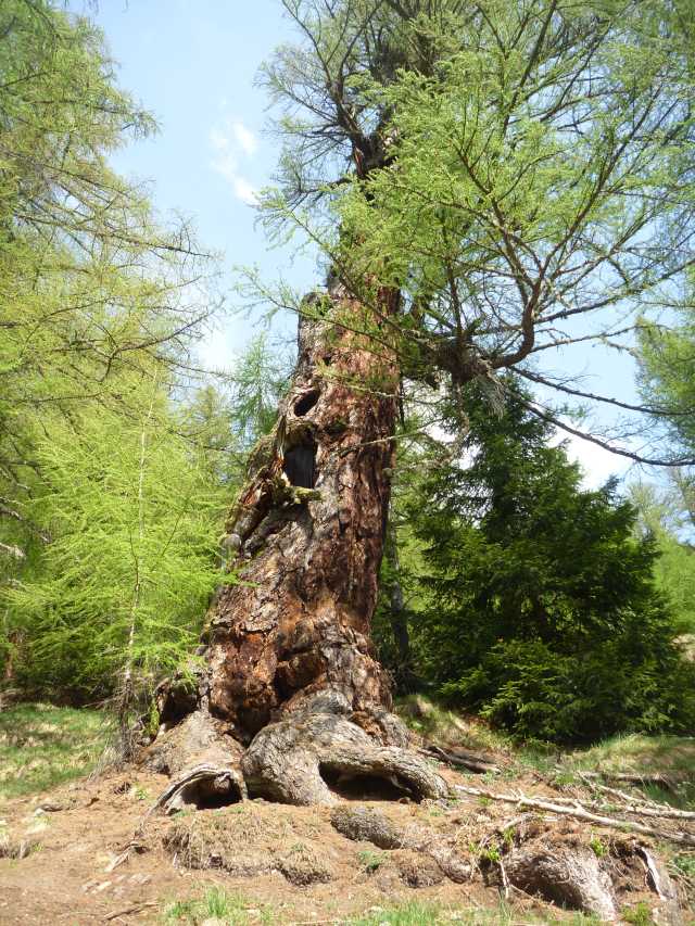
 About
500 m after crossing Millibach, above Obergesteln, a board points to one
of the oldest Larch tree. The climb to the 700 year old tree is pretty
steep, but just a few meters above the tree, a drive way down will merge
with our former Hiking track, so one does not have to retrace on the steep
path. Track closed, the tree could collapse anytime. About
500 m after crossing Millibach, above Obergesteln, a board points to one
of the oldest Larch tree. The climb to the 700 year old tree is pretty
steep, but just a few meters above the tree, a drive way down will merge
with our former Hiking track, so one does not have to retrace on the steep
path. Track closed, the tree could collapse anytime.
top of page
Interactive map:
map.search.ch/d/mqxodk5nt?x=2168m&y=1448m
GPS-route:
GPS_Data/GPX-Bellwald-Reckingen.zip
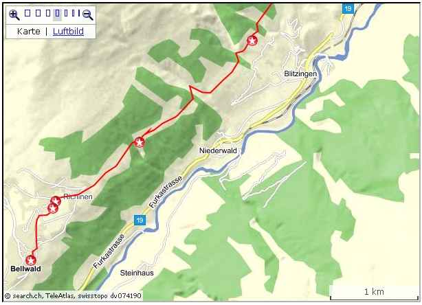
The holiday village Bellwald can
be reached by a small cable car from Fuergangen, integrated into the
MGB Railway station.
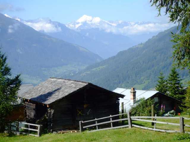
Bellwald is a holiday village with a large part of old Valais houses and
is beautifully situated on a slope above the upper Rhone valley (Goms),
and the Fieschertal.
The cable car: It is operated from
the Bellwald station. Time table is on the wall. Just get into the cable
car and wait. On time, after a ring, the door will be closed
automatically. Cashier and operator is at the top.
| Bellwald-Reckingen |
hrs |
Zug-Goeschenen-Andermatt-Realp-Fuergangen (train)
Fuergangen-Bellwald (cable car) |
|
Bellwald-Sportplatz-Willere-Igschene-Ammere-
Selkingerchaeller(Walibachhuette)-Millerbine-
ZGufersmatte(Haenggisch Hittae)-Reckingen |
5.0 |
| Reckingen-Andermatt-Goeschenen-Zug (train) |
|
Start of the Gommer Hoehenweg is in the
 Sport area. On the walk up
there one gets a glimpse of the old part of the Village with the little church in
the center. Proceeding on pleasant path ways, pretty newer Chalets are passed.
The environment is lush with Pine trees and grass and flowers and there is
also a tiny lake. Sport area. On the walk up
there one gets a glimpse of the old part of the Village with the little church in
the center. Proceeding on pleasant path ways, pretty newer Chalets are passed.
The environment is lush with Pine trees and grass and flowers and there is
also a tiny lake.
The track then
becomes an easy walk, 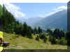 descending slightly to the area with
the Deer enclosure in the Ammere region. The altitude is now, after
crossing the Wilerbach, some 1450 m, the lowest point. After that it's mostly climbing up until crossing
Walibach, at about 1680 m. The area has been given the name Selkinger
Chaeller (Chaeller=cellar): in the summer it's refreshingly cool
here. descending slightly to the area with
the Deer enclosure in the Ammere region. The altitude is now, after
crossing the Wilerbach, some 1450 m, the lowest point. After that it's mostly climbing up until crossing
Walibach, at about 1680 m. The area has been given the name Selkinger
Chaeller (Chaeller=cellar): in the summer it's refreshingly cool
here.
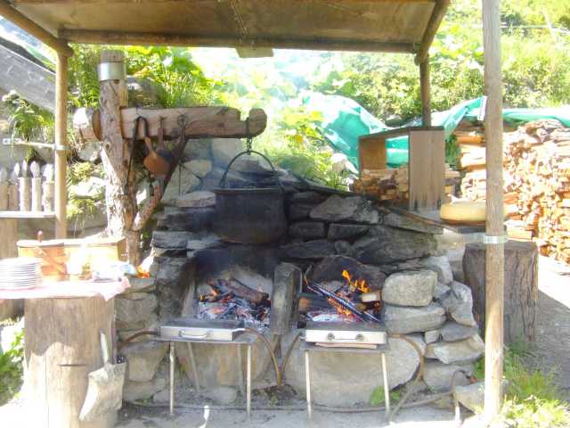
Tempting there
is the small Restaurant, the Walibach  Hut, with its genuine
Raclette. On an
open fire the Valais specialty is being prepared in its real, original
way. Valais white wine is available too, of course. Hut, with its genuine
Raclette. On an
open fire the Valais specialty is being prepared in its real, original
way. Valais white wine is available too, of course.
Then
the
Reckingerbach in the Baechital is crossed. Here in the Gufersmatte Hut (Haenggisch 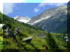 Hittae) is again provided for Eat and Drink. Hittae) is again provided for Eat and Drink.
After a short climb we have now reached the highest point at about 1780 m.
After that we're on the
downhill track to Reckingen, shortcutting the drive-way.
The mentioned Restaurants are open every day from June through
October (depending on the weather).
top of page
 Active
map: Active
map:
map.search.ch/d/ju4m2flzd?x=-2128m&y=-1456m
GPS-route:
GPS_Data/GPX-Oberwald-Gluringen-Waldweg.zip
Ca. 5 hrs.
Shorting other stretching the route is easily possible. Starting from the
different villages with the MGB Railway stops there, alternative Starting
and Endpoints can be chosen.
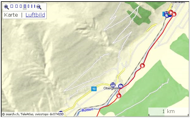
From the Oberwald MGB Railway station we use the underpass and
in the Southern direction we head for the bridge over Rhone (Rotte). After
crossing the river, turning downriver we're walking right along the
riverbank. Although the first 600 m are not the official route, at the
Golf range we hit the "legal" route. We proceed until the bridge at Obergesteln
is reached. Reaching the Golf range, a board cautions for flying Golf balls,
but its more probable to being kissed by the water off the sprinkler. This
first part is on the "Rottenweg".
At Obergesteln the track for the "Waldweg" could be hidden
when the grass stands high. The dirt track trough the pasture begins after
about 100 m on the Bitumen road between Hotel and Restaurant, up to
the right. After a few Minutes the forest track
is clearly visible.
After Obergesteln the track is heading to the settlement Loch with
old stables and the chapel St.Anna.
After passing the Nufenen pass road the route now runs along the Aegene
river. Just before reaching the Camping ground of Ulrichen, the
track on the left is heading up to our "Bergweg" and from now on, the route runs on a level
between 1400 and 1500 m. Flat sections are followed by ascents, to be
succeeded by a descents.
 Along the lovely forest track the sight time and again wanders over to
the slopes and cuts along the other side of the Gommer valley. Along there
runs the "Gommer Hoehenweg" from Oberwald to Bellwald. Along the lovely forest track the sight time and again wanders over to
the slopes and cuts along the other side of the Gommer valley. Along there
runs the "Gommer Hoehenweg" from Oberwald to Bellwald.
From the MGB-Railway station at Fuergangen (with 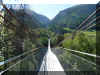 cable station car to
Bellwald) we cross the Railway-Line
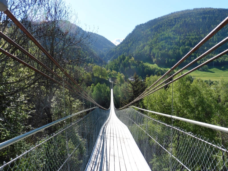
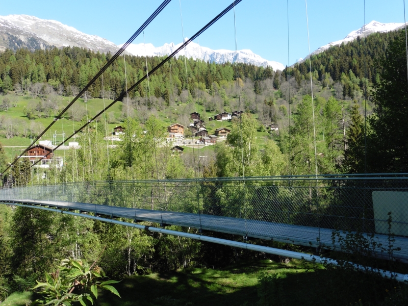
and follow the Bitumen road down to the Main road, the Furkapass road. For
the crossing over to the suspension Bridge we're using the underpass,
which brings us directly to the Bridge.
cable station car to
Bellwald) we cross the Railway-Line
and follow the Bitumen road down to the Main road, the Furkapass road. For
the crossing over to the suspension Bridge we're using the underpass,
which brings us directly to the Bridge.
Across, there are 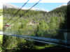 boards
with informations and proposals for a couple of interesting tours starting there.
There is also a piggy-box if you want to make a contribution for the
bridge. boards
with informations and proposals for a couple of interesting tours starting there.
There is also a piggy-box if you want to make a contribution for the
bridge.
The "official" route is leading up to the forest and through
the village of Muehlebach.
An extension of the hiking track is leading up to Chaeserstatt.
I chose to follow the Bitumen road, which will join the road between Steinhaus
and Muehlebach.
 Interactive
map: Interactive
map:
https://map.search.ch/d/tnmzwrknt
GPS route:
GPS_Data/GPX-Gluringen-Furgangen2.zip
In order to reach the "Rottenweg", first
the MGB track has to be under passed. Then, after bypassing the barracks,
we cross the Rhone river (Rotten). After the weir with the reservoir we're
on the comfortable walking track.
 After a first Camping ground, at the turnoff for
Ritzingen (the Ritzibrigge), the road leaves the riverbank. Another
idyllic Camping area is bypassed and at Bieligermatte we're heading again
towards the river. After a first Camping ground, at the turnoff for
Ritzingen (the Ritzibrigge), the road leaves the riverbank. Another
idyllic Camping area is bypassed and at Bieligermatte we're heading again
towards the river.
The following light woods contains a fish
hatchery  with a small Restaurant. Fishing rods can be rented and the catch
may be cleaned and cooked right on the premises. Some chores of course may
be delegated for a small charge. with a small Restaurant. Fishing rods can be rented and the catch
may be cleaned and cooked right on the premises. Some chores of course may
be delegated for a small charge.
The
route continues along the Rotte. About 750m after the bridge for
Blitzingen, we're following the railway track along the right side of the
stream. After the gallery we're crossing back over to the other side by
the Niederwaldbridge. A short climb follows. For Rhone river the space has
narrowed now and the valley is now deeply cut.
At
Steinhaus we are almost 100m above the river. Steinhaus too has a long and
eventful history. The tower suggests that here probably was a small
citadel or a superiors residence. See Link to Ernen and history.
 A
marker points for the track to the tower and the road through the hamlet.
After 200m it merges with the Bitumen road to Muehlebach and Ernen. A
marker points for the track to the tower and the road through the hamlet.
After 200m it merges with the Bitumen road to Muehlebach and Ernen.
The tunnel at Loeuewibach (avalanche-creek) can be detoured by a footpath
on the right.
The suspension bridge now makes an easy
crossing over to Fuergangen. The
From the village a couple of
tracks are ready for hikes up to Chaeserstatt and Ernergale, to Ernen and
continuing by the Galgen (gallows) to Fiesch and "Fiesch Sport und
Feriencenter".
Ernen-Muehlebach
Circle walk Muehlebach-Ernen-Gallows-Muehlebach
Reaching Muehlebach, a closer look into the hamlet awards with remarkable
insights to old house constructions. Don't miss the little church.
Brochures are provided from a box along the way.
This is not Disneyland,
it's a normal living community.
From Muehlebach two beautiful tracks connect with Ernen, which is another
"must see". One track (To Ernen ?) begins after the old
Bakehouse over the little bridge.
The other (Return path ?) is to the North of the Bitumen road and is passing
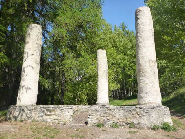
the Galgen (Gallows).
 |
 |
 |
 |
| Left, across valley is Fuergangen,
behind Muehlebach-church is Bellwald |
Shady resting places at the Gallows |
Remnants of the Gallows |
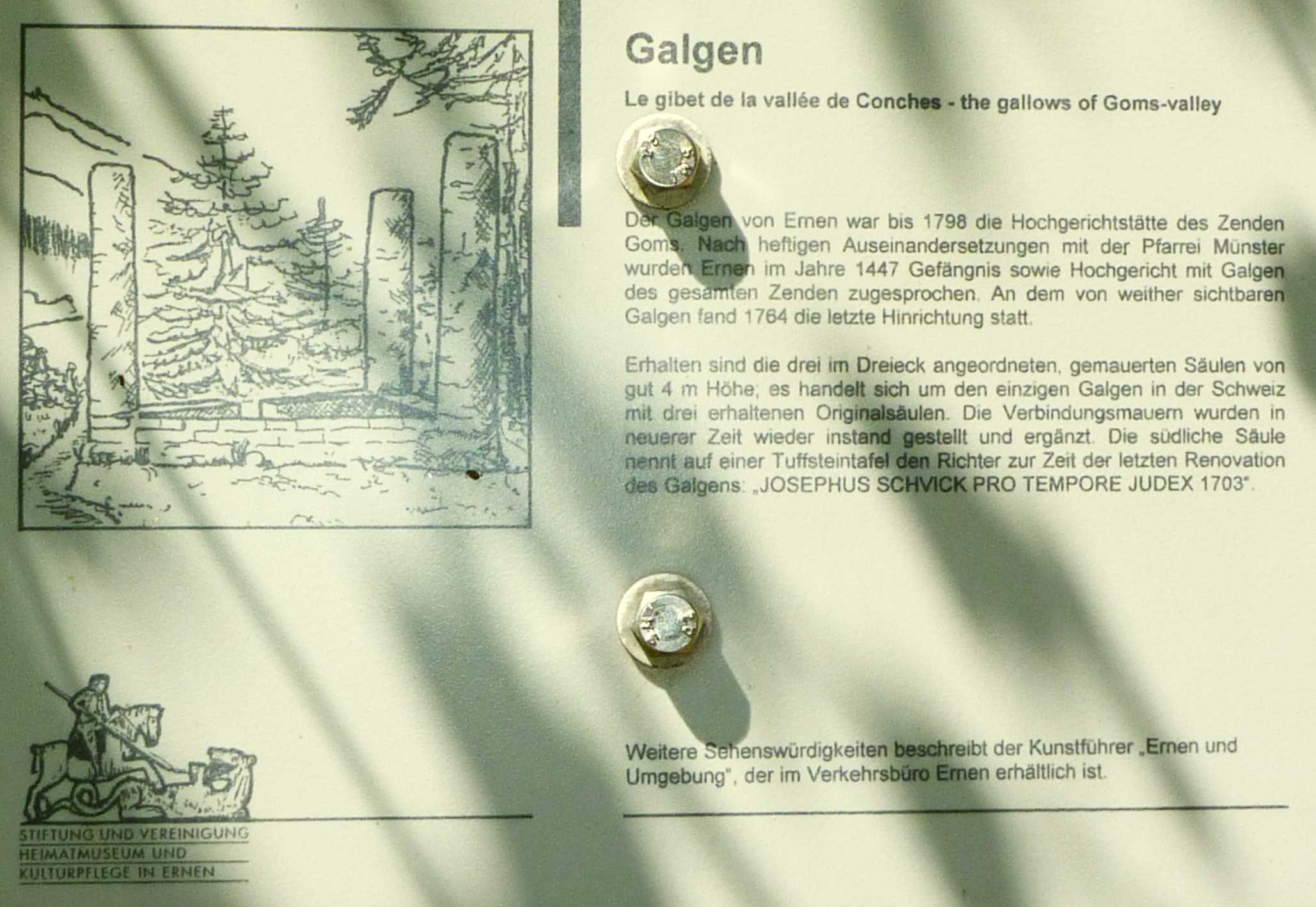
Info-Board: Gallows for the criminal
court of Ernen until 1798. Last execution 1764. |
 Interactive
map: Interactive
map:
map.search.ch/d/tewodu5nt?x=-480m&y=176m
GPS-route:
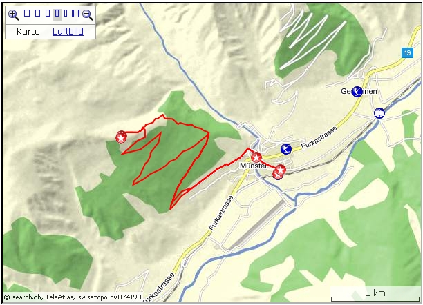
GPS_Data/GPX-Munster-Galmihutte.zip
4.5 hrs return
On the shortest way it takes some two to two and a half hours from the Muenster
MGB-Railway station to the Hut. Although the "Hut" 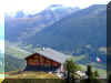 there is a
three storey Chalet! - with a homely mountain Restaurant. Check for
opening hours, usually "officially" open only July through Sept. there is a
three storey Chalet! - with a homely mountain Restaurant. Check for
opening hours, usually "officially" open only July through Sept.
My route up: Goeuchette - Judestafel - Salgaebi.
The lower part of the road is Bitumen surface. After a couple of
turns it is gravel. A little later, at a group of weekend homes, we've
reached the track of the "Gommer Hoehenweg". After crossing that
track and following the upgoing road (I didn't recognize a sign for
Galmihuette) for another km we're confronted with two options: choosing
the steep forest track, or following the gravel road. For the way up I
chose the pretty steep forest track. On the way back I preferred the
gravel drive way.
From Oberwald to Niederwald there is a whole bundle of winter trails to
choose from.
Also over at the Steinhaus to Ernen area (with Bus
connections from Fiesch) trails are prepared for the hikers.
Up at
Bellwald (cable car from Fuergangen MGB-stop) and in the Oberwald area are
winter trails too.
Gluringen to Oberwald
 Interactive
map: Interactive
map:
http://map.search.ch/d/ta5yzvmym
GPS-route:
GPS_Data/GPS-Gluringen-Owald-Winter.zip
(3.5 hrs) At the Gluringen railway stop I chose a short detour up to the
mainroad;
then passing the house of the village administration, after that I crossed
the road to the cheese shop to get me
some goody's.
From there, just about 50 m on the same roadside, towards Gluringen, a short
private road is heading to a cabinet makers enterprise. Right there a
track is cut in the snow which connects with the "official"
winter trail.
 All the trail are nicely laid into plains, more or less flat, sometimes
a trail hits or crosses a cross country ski trail, but it is always a separate
tracks. All the trail are nicely laid into plains, more or less flat, sometimes
a trail hits or crosses a cross country ski trail, but it is always a separate
tracks.
The scenery is lovely: sugar covered trees, scenic views to the villages in the
distance, the  shiny mountains, the tree-flanked rivers, the skiers gliding in the distance..
It's a peaceful atmosphere. shiny mountains, the tree-flanked rivers, the skiers gliding in the distance..
It's a peaceful atmosphere.
The nice thing is, that there are many options to choose from and a railway
stop is always near.
The
villages on the other side of the Rhone
Steinhaus, Muehlebach, Ernen, Niederernen, Ausserbinn
The continuation of the
Rottenweg gets us in contact with history.
At first sight it's amazing, that suddenly there are villages on the
left side of the Rhone river, away from the main road.
The explanation is simple: today's road was built 1861 and the line
of the Furkabahn (today MGB, Matterhorn Gotthard Bahn) is in
operation since 1914.
Before, the roads or mule tracks were running by Ernen and
Muehlebach towards Obergesteln/Zum Loch for Furkapass or Nufenen/Griespass respectively. Another road was leading by
Niederernen through Binntal over Albrunpass to Italy. In the other
direction, the Gommer road was heading down to Brig with the
Simplonpass passage to Italy.
So, with the new road and the train track, the Villages mentioned
above were put on the sideline.
The positive side of it is:
Steinhaus, Muehlebach, Ernen, Niederernen and Ausserbinn are well
maintained old Walliser villages. Those are not museum sites.
Renovations and new buildings are being done with great care.
|
Ernen,
History:
Ernen
today consists of hamlets Ernen, Niederernen, Ausserbinn, Muehlebach,
Steinhaus.
Tomb
sites suggest, that in pre Christian times already people have
settled in this area. Goms was subordinated to Ernen,
according to a deed from the 12th Cent.
In the 14th Cent. there were the two administrations: Muenster
and Ernen. The power of High court though was always in Ernen.
The Gallows in Ernen was renewed in 1702.
For the Catholic Church Ernen was always important: aside
from Muenster was Ernen the second Main-parish in Goms. The church
is firstly mentioned in a document of 1214.
Stately
homes indicate prosperity. See Link to
Ernen (In Ge).
Muehlebach
is known as the village with the oldest still existing central part
of wooden houses.
The village was first mentioned in a document of 1215.
17 houses
were built before the 17th Cent.
Cardinal
Schiner, in the 15th/16th Cent. a very influential man, was born in
Muehlebach. He had often his hands in the plays of politic and
church: in the Leventina,
in Bellinzona, in the connections of the families Visconti, in the
strategic positions of the Canton Uri and the Swiss Federation,
in the catastrophic battle in Marignano, in the disputes between
Italy and France. He was good friend with the Zurich Reformer
Zwingli, but turned against him when it came to the split in the
church. (See remarks on the Biasca part in Leventina)
Marignano
was a turning point in Swiss history.
There were Swiss mercenaries on both sides of the forces; in
reality Swiss were killing each other in the name of their
respective "owners". Realizing this perversity, the
Tagsatzung declared "Reislaufen" (engage into foreign
military service) unlawful after that bloody battle.
Siehe
Links (In Ge).
http://en.wikipedia.org/wiki/Matthäus_Schiner
|
Book (in Ge): Walliser
Totentanz
|
On the main road Oberwald to Brig, on the left after passing Reckingen
but before entering Gluringen there is a cheese dairy with shop.
Among other products is the "Baschi", a whole
cheese of about 1 kilo: tasty, and handy to take along.
www.biobergkaese.ch/
|
top of page
|
In
the historic context
Reading
Pirmin Meier’s Book about Micheli du Crest, I stumbled over
a section where Wenger Baschi is mentioned. Here a summary:
In
the late 18th Century
Switzerland
was more or less
a French Satellite. French Emissaries had the saying in important
matters. In many regions unrest, frustration, hatred against the
foreigners was growing.
In the upper Valais region (Oberwallis) citizens were not
interested in „new opportunities“: they were happy with the old,
very liberal rights and rejected the new rules (like paying new
taxes). When even under their own neighbors some demonstrated in
favor of the French, the fire was ignited.
A
young giant of a man by the name of Sebastian
Weger of Geschinen protested
loud and clear. In May 1798 Baschi (short for Sebastian) stated,
that he would march down to Sion and teach them a lesson and he
would even march on to
Lausanne
, even to Paris.
His family had
a tradition of serving as mercenaries and Baschi declared himself as
officer, to lead his group against the foreign rulers. He pretty
quickly found supporters in his Goms vicinity, and marching
down to Sierre the Protest group had grown to an army of 5’000.
Now with this size, they needed a Professional as leader. He was
found in the person of Joseph von Courten in Siders (=Sierre). In
the lower Valais (Unterwallis) a troop of 1'000 man under Captain
Jacquot joined them.
In
the confrontation with regime-friendly Unterwallis soldiers,
enforced with 1400 Vaudois (Waadt) troops under General Bergier, the
situation looked pretty good for the army with Baschi. But now, in
the view of success, some wanted to go home, and also ammunition was
in short supply. Baschi’s army got into disarray. Finally they
lost on May 17th 1798 against the army of General
Schauenberg. Some 300 man became prisoners and they were jailed in
the Chateau Chillon.
The
situation in the prison was so horrible, that the French commander
decided to let most of the prisoners go, except for the 61 bad guys.
They were transferred to
Berne
for prosecution.
In
the mean time new uprisings broke out in
Central
Switzerland
. These conflicts
were considered much more grave, and so most of the prisoners were
released, except for Jacquot, the monk Ebner and Baschi Weger who
was considered the ringleader who started the avalanche.
They
were incarcerated in the Aarburg, the citadel, where Micheli du
Crest had been prisoner too. A few months later the three were
released.
Baschi
refrained from getting involved in new insubordination. According to
tale, he served under Napoleon in the offensive against Russia
.
Weger Baschi, Geschinen: 1759-1832
(See www.obergommer.ch/genealogie/5017.htm)
Base of the excerpt:
„Die Einsamkeit des Staatsgefangenen Micheli du Crest”:
Pirmin Meier (Pendo Zürich, München)
Micheli du Crest was a Scientist (he invented a new Thermometer), an
Engineer (as Officer a respected specialist in Defence
constructions), he criticized the political System in Geneva
as being an Oligarchy (he agreed with the ideas of Montesquieu
(1689-1755)).
He was found guilty of high treason and was symbolically beheaded in Geneva.
Later he was kept prisoner in the citadel Aarburg for 19 years. He
was wealthy and had contact with many famous people: Brothers
Bernoulli, E. Lessing, J.W.Goethe, Georg Zimmermann, S.Henzi, J.J.Rousseau.
The systematic mapping of
Switzerland
that began under General Dufour was mainly based on du Crests
proposals. The decision for the removal of the
Geneva
Defencewalls in the 20th Century used many of du Crests
arguments. The new Swiss Democratic system of
1848 contains many of du Crest’s ideas |
|