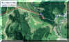
Napf
The easiest way for reaching the Napf area is by Romoos, Menzberg,
Luthern/Luthern Bad, or Fankhaus. Similar to Rigi, Napf is the highest
Point in a large area, so there are unsurpassed views in every direction.
| Luthern Bad - Napf - Luthern Bad |
Km |
hrs |
| Zug - Luzern (SBB) |
|
|
| Luzern - Hüswil (Regional) |
|
|
| Hüswil - Luthern Bad (Bus) |
|
|
| Luthern Bad - Badegg - Nieder Aenzi - Grüebli - Napf |
4.5 |
2 |
| Napf - Trachselegg - Vorder Ei - Luthern Bad |
3.5 |
1.3 |
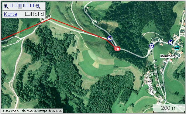
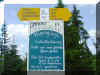
A informative Board In Luthern Bad tells a lot about the region and the
hiking area. There is also a tidy public toilet and space for parking
available.
The ascent from Luthern Bad to Napf:
From the Info Board after a few meters the trail crosses the river and
soon we're ascending a fairly steep but excellent gravel road up to
Badegg. The river is running far below in a gully. Soon we arrive at the
Bitumen road. It's replacing what is now the hiking track, making live for
the farmers a bit more secure. Badegg, a summer Restaurant can now be
reached by private cars.
After Badegg we're again on gravel road. In the forest we are
steadily
ascending. From time to time nearby hills and valleys can be seen in but a
narrow cutting.
 |
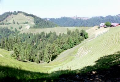
On the way to Napf,
Nieder Aenzi |
At Nieder Aenzi we're suddenly on a crest which opens the view over to
the other side towards Entlebuch.
Soon on a lovely narrow track we're proceeding through forest to
Gruebli, all the time following a ridge.
After Gruebli, the last part, it's a steep climb again. After less then
half an hour we're on top of the Napf.
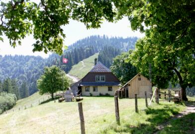
For the way back from Napf to Luthern Bad we're using the track
by Trachselegg and Mittler Ei.
The track begins near the Farm house. On a steep zigzag course we're at
Trachselegg (summer Restaurant) in less then half an hour.
 |
Napf to Luthern Bad,
Trachselegg |
Through forest and meadows we're descending to Mittler Ei. Here we hit
the Bitumen road. The hiking track is a gravel road. Crossing the Luther,
it runs along the river in the shadow of the trees. A connoisseur
might want to use the opportunity to cool down the feet. Who knows,
perhaps at the same time a tiny piece of gold will show up?
Soon we cross the river again. After a short walk on the Bitumen road
we're back at where we started.
 Active
Map: Active
Map:
http://map.search.ch/d/ju3mmnkod
GPX-Route:
GPS_Data/GPX-Menznau-Napf-Fankhaus.zip
| Menzberg - Napf - Fankhaus |
hrs |
Zug - Luzern (SBB)
Luzern - Menznau (BLS)
Menznau - Menzberg Oberlehn (Postauto) |
|
Menzberg-Oberlehn-Ob.Waldig-Gmeinalp-Gitzichnubel-
Chrotthütten SAC-Staechelegg-Napf |
3.0 |
| Napf-Grueebli-Hoehstullen-Buechli-Leen-Fankhaus |
2.0 |
Fankhaus Schulhaus - Trubschachen
(Postauto) Check time table!
Trubschachen - Luzern (BLS)
Luzern - Zug (SBB) |
|
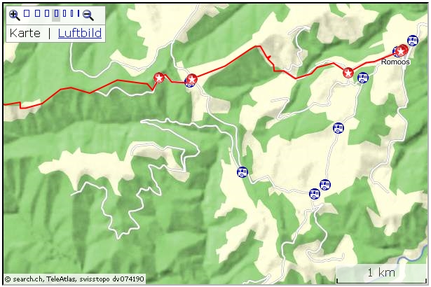
Just before reaching Menzberg there is a Bus stop at the crossing for Oberlehn.
An ideal starting point, but of course, start in Menzberg is possible too.
That track would merge after some 500 m with the one from the mentioned
Bus stop.
On the direction board are
quite a few proposals for routes in this area. Estimated walking time is 2
hrs and a half, but let's add another 30 Minutes for sights and may be a
rest while doing the steeper part near the end.
The part to "Chrotthuetten" is pretty comfortable and the
scenery lovely. Sometimes a special bypass for hikers is provided. Soon
after the SAC-hut, a steep track will lead up to Staechelegg. After that,
it's another 20 Minutes to the peak.
For the way down I chose the shortest route to Fankhaus. For the steep
descent you'll be happy having the walking sticks with you. As an
alternatve, a less steep
but longer route is marked.
When too early for the Postauto, enjoy the quiet and coolness just
after leaving the forest, some 15 Minutes from the end of the hike. A wooden
bench is just at the perfect spot; the next Restaurant would
be in Trub, a one hour walk from the bus stop!
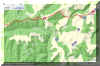 Active
map: Active
map:
http://map.search.ch/d/tuymtu4ng
GPS-route:
GPS_Data/GPX-Romoos-Oberanzi-Napf-Trub.zip
| Romoos - Ober Aenzi - Trub |
hrs |
Zug - Luzern (SBB)
Luzern - Wolhusen (BLS)
Wolhusen-Romoos Post (Postauto)
Some Postauto will extend their route to Holzwaegen. |
|
Romoos-Weierhuesli(saw mill)-Saeumettle-Fuchsenegg-
Holzwaegen-Goldsitenegg-Aenzihuesli-Ober Aenzi-
Staechelegg-Napf-Staechelegg-along Trimle Rim-
Schafegg-Champechnubel-along Stutzegg Rim-Graetliegg-
Altgratschwaendi-Ober Altgfael-Hinter Risiegg-
Schwindelegg-Trub
Skip Staechelegg-Napf-Staechelegg
Romoos-Holzwaegen by Postauto (May...Oct)
|
9.0
-1.0
-1.5
|
Trub - Trubschachen
Trubschachen - Luzern (BLS)
Luzern - Zug (SBB) |
|
Postauto: Check timetables!
This longer tour will give a good insight into this fantastic
region with the forests, the many alpine farmhouses, the knolls, valleys,
ridges, creeks. Sometimes, in between, there are small plains as well.
Near the Bus stop in Romoos, close to the catholic church "Maria
Magdalena", a board provides information about the many hiking and
special tours that can be undertaken.
The first part is on the Bitumen road down to Weiherhuesli with the saw mill.
After a right turn there, and some 200 m, a forest track on the left is provided.
Soon we're on the Bitumen road again, but only for a short section. Then the steep climb up to some 1000 m is demanded.
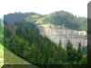
At Fuchsenegg,
about half way up, we're getting a fine view of the undulating
scenery.
Having reached Graemsen, it's now an easy half hour walk to Holzwaegen.
From now on the sight opens into the Lucerne "Hinterland". Some Postauto courses serve this area, which is an excellent starting
point into the Napf region. The Restaurant has a large garden area .
Parking space for private cars is provided some 500m from the Restaurant en route for
Ober Aenzi.
To Ober Aenzi we're often walking along a rim, slightly
ascending and every now and then offering lovely sights. Passing
Goldsitenegg with the Goldbach deep below, may trigger some thoughts about
a Goldwash expedition. After one hour
we're at the Restaurant and here again the view from the garden Restaurant
stretches wide to the Jura mountains in the North.
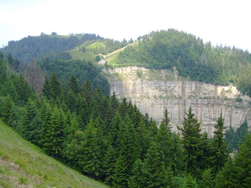
 On the way towards Staechelegg the eroded flank
of Hengst is in
view, with the Napf summit to the left (the knoll on the right is Hengst).
The farmhouse Staechelegg is built almost directly above the abyss. On the way towards Staechelegg the eroded flank
of Hengst is in
view, with the Napf summit to the left (the knoll on the right is Hengst).
The farmhouse Staechelegg is built almost directly above the abyss.
Before reaching Staechelegg, the route to Trub turns left. The detour to
Staechelegg and Napf and return would take about one hour.
The track from Aenzilegi (just before Staechelegg) to Schafmatt is
following the border Luzern/Bern. The scenic "Grenzpfad" follows
the rim, sometimes a bit up, then again descending, but most of the time
at an altitude of some 1200m. It's a superb hike for getting an
insight view of the Napf area.
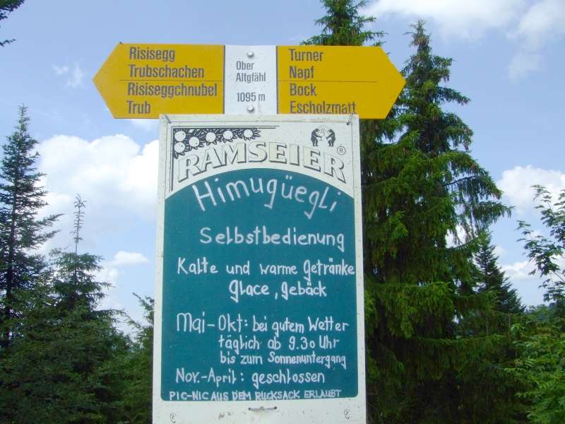
 At
Altgfael a "help your self" Beizli might provide the hiker with
new energy. At
Altgfael a "help your self" Beizli might provide the hiker with
new energy.
(Himugueegli is a ladybug; for Nonberner a Marienkaefer).
The last part, from Schindelegg to Trub, by the bridge over
Trueb river, is on a narrow, steep dirt track.
As an alternative, the way to Trubschachen is with one and a
quarter hour only some 45 Minutes longer.
| Gold or cookie?
While some of the hikers are searching the Napf rivers for gold,
others perhaps prefer a visit to the cookie factory shop of
Kambly SA in Trubschachen:
The factory is located directly at the railway station. The shop
entrance is at the remote end of the long building on the mainroad (direction
Luzern), 10 Minutes return.
The Best: you can also taste all the goodies.
Info: www.kambly.ch
Malters is home of two big names, Hug and Wernli, with the shop
"ChnusperLand". See www.hug-familie.ch/en/home/,
with link and infos to another product, the "Willisauer Ringli"
and its shop "RingliLand".
Since we're alright in the midst of genuine Swiss cookies, here
the Link to the other Big Name: www.laeckerli-huus.ch/
|
|