|
||||||||||||||||||||||||||||||||||||||
Zug, located between Zurich and
Lucerne, is a perfect place for Zug, zwischen Zürich und Luzern gelegen, ist ein
idealer Ort für
|

|
|
|
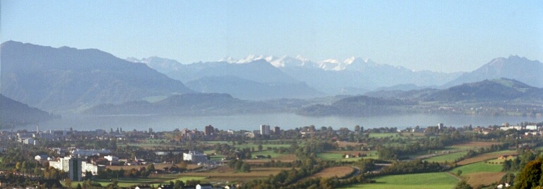
Rigi, Zugersee,
Stanserhorn, Berner Alpen, Pilatus |
|
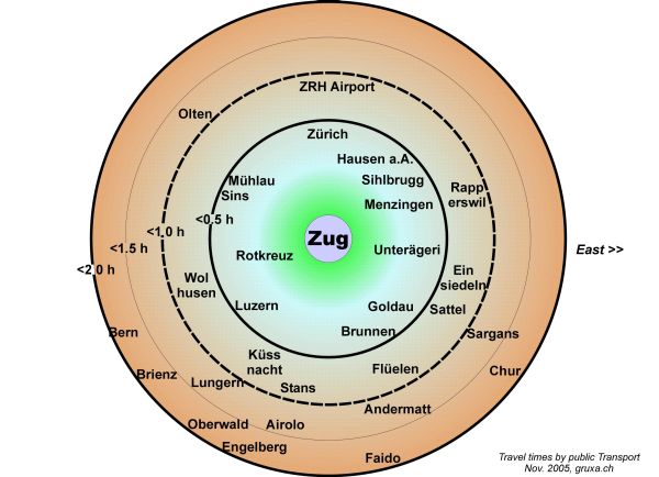
Distanzen ab Zug in Stunden mit öffentlichem Verkehrsmittel |
|
|
|
Distances from Zug in hrs by public Transport |
|
Last change: 16 Juli 2023 |
(c) |