Ca. 4 hrs.
The
first part of this route is the same as for the Milchsuppenstein.
Leaving
the lovely lookout/picnic place we proceed towards Ebertswil. After
crossing the main road at Ebertswil and passing the houses and stables
we’re again walking between meadows and fields, enjoying the view into
the
Berne
Alps.
The Albis hill is to our right (or East) and somewhat in the distance (NE)
the spire of the Hausen church is embedded into the greenery. Then the route
makes a turn to the West.
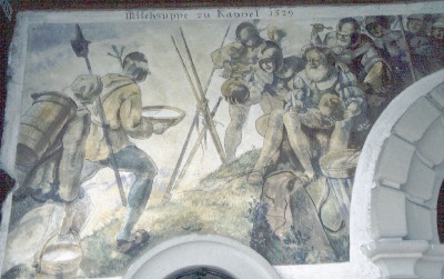
Approaching the woods edge there are two choices: straight on to the Zwingli
memorial, or turning left to Kappel.
For
the Zwingli memorial the detour takes some 20 Minutes.
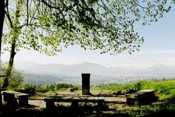
On a podium between two giant
Linden
trees a board on a
rock reads Zwingli’s statement that” they may kill the body, but not
the soul…” Just across the
memorial the hamlet Naefenhaeuser reminds of the connected
historical background: Adam Naef in the battle of 1531 had saved
the banner of the Zwingli army from being taken by the Catholics. For that
deed he was rewarded later on with the fief of the Sennhof (part
of the property of the former monastery Kappel), further with the Zuerich
citizenship and the membership in the guild „zur Meisen“. Later
descendants were entrepreneurs in the Silk and Half wool business.
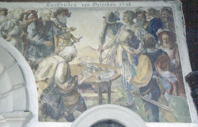
In
Kappel, after crossing the main road, the route passes a little pond, the
former monastery and other houses belonging to that
property; one is now a Seminar center with the „Haus der
Stille“ and cultural Center, another is a public Restaurant.
Then
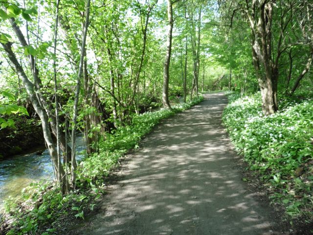
we’re again crossing fields, marshland, and woods.
Arriving in Uerzlikon, we turn right and after some 180 m we’re on a
Wanderweg again. Pretty soon the road enters a small forest and we find us
walking down along a little gorge. Leaving the woods we’re again on a
marshy plain on the way to Steinhauser Wald.
The
trail passes the popular small lake. Leaving finally the forest we’re
soon at Hinterzimbel and on the way to Baar.
see also Albis on Zuerich page
Restaurant closed on Thursdays (Apr 2009)
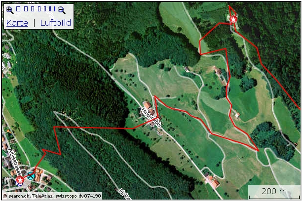
 Active map:
http://map.search.ch/d/2fhmjm4zj
GPS-route:
GPS_Data/GPX-Albishorn.zip
Bus-Tickets: Although Line 280 (Baar-Hausen) is part of the
Zug public transport System, the part "Bachtaler Hoehe" to
"Hausen" has to be paid for in the bus.
Albishorn and the popular Restaurant is accessible by excellent hiking
tracks.
At "Post Hausen" (Terminus) we cross the main road over to
Restaurant Loewen. There after 20 m we get to the turnoff of the walking
track which crosses the pasture and is entering the forest. Steady, but
never really steep we will reach the hamlet Hinteralbis after some 20
Minutes.
After crossing the road a smaller street (Bitumen) is leading in wide loops
to the forest. Then we're on a field track that follows the edge of the
woods. At the turnoff we're entering the forest track that will bring us
up to the summit.
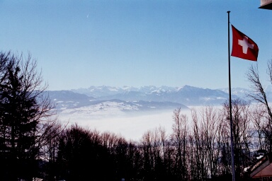
 Up here on the Restaurant terrace as well as on the platform above we
enjoy a superb panorama.
Up here on the Restaurant terrace as well as on the platform above we
enjoy a superb panorama.
The way down to Sihlbrugg is generally following the rim of the
mountain. At first we're on a forest track, later it's an excellent gravel
road that will bring us finally to Schweikhof. At Oberalbis there are two
options: either the track along the rim, or the "Aussichtsweg".
Latter will allow lovely sights over Lorze-plains, into Urner and
Nidwalden mountains and the lakes. At Mattli the two routes merge.
At "Schweikhof" we find the continuation of
the track after we've surrounded the popular Restaurant. The grass path turns off to
the right and crosses the pasture over to the forest.
Reaching the forest we follow the road along the ravine. The creek has cut
almost vertical walls out of the mountain. It accompanies us all the way
down to Sihlbrugg.
The bus stop for Baar is at the river Sihl (Near Restaurant Loewen) on
the road to Neuheim.
As an alternative there is a forest track from Albishorn down to
Sihlwald or Langnau stations (about 1 hr) with railway connections to
Sihlbrugg.
To Albispass it's about 70 Minutes, to Felsenegg 2.5 hrs.
Option for private car:
You may drive up to the parking after Mittleralbis. The turnoff is near
the "end" sign of the village Hausen towards Albis pass (sign "Albishorn",
shooting range).
From the parking it's a half hour walk up to the summit and about 20
Minutes back on a good road.
If you'd like to extend the walk by some 20 Minutes:
Follow the driveway for another 200m. After reaching the first stable at
Oberalbis, a track to the left is leading upwards to the woods. There, a
lovely path runs along the rim to Albishorn.
Top of page
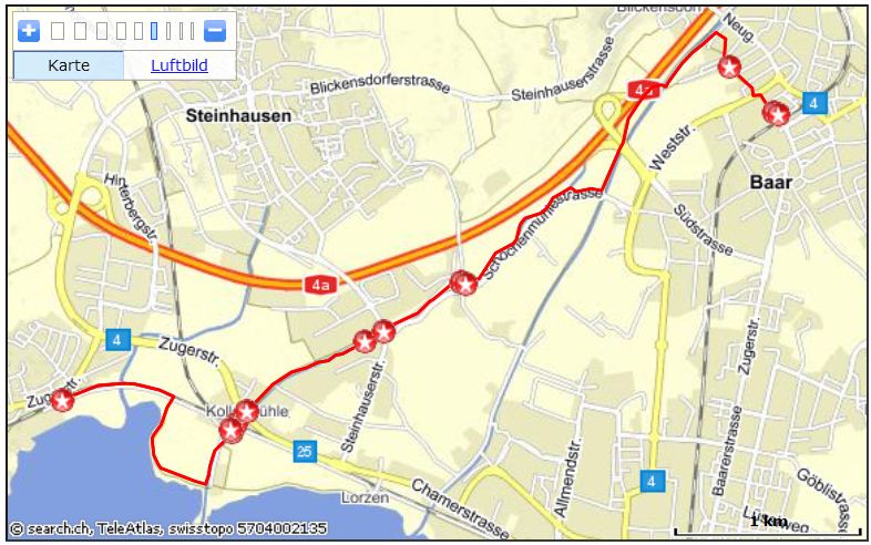
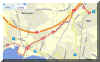
Along the old Lorze river to Zugersee
 Interactive
map:
Interactive
map:
http://map.search.ch/d/gzkyty1nd
GPX-route:
GPS_Data/GPX-Baar-Cham_Alpenblick.zip
On plane and well maintained roads one gets a good impression
both of the history of industrializations and the changes in the habitat.
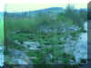
The Lorze plains has gone through drastic changes in the last years. Reed
has been transformed into roads and industrial zones. The river Lorze was
moved into a new bed. By successful renaturation
new nature zones have been built.
Boards of the "Industriepfad Lorze" on many
places illustrate the development in the region. (www.industriepfad-lorze.ch).
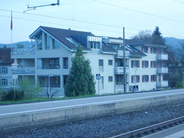
 Right at the Baar railway station stands a unnoticed
relict from industry history; the useless Obelisk at the eastern end of
track 3 (Zuerich) is a forgotten remainder of the power line pylon who
carried the wires from the electric power generator in Schochenmuehle to
the nearby Neumuehle (grain mill).
Right at the Baar railway station stands a unnoticed
relict from industry history; the useless Obelisk at the eastern end of
track 3 (Zuerich) is a forgotten remainder of the power line pylon who
carried the wires from the electric power generator in Schochenmuehle to
the nearby Neumuehle (grain mill).
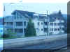
From today's parking lot a subterranean channel under the road made it
possible to move grain, delivered by train wagons, directly into the store
rooms. The blue building with the Restaurant was the mill, the silo has
been replaced by the modern high-rise
building of "Gotthard Center".
The walk begins right at the northern side of the
railway station in the direction of "Waldmannhalle".
Passing through between gym of the school and the Waldmannhalle we're at
the bridge over Lorze. Across are leisure ground a modern Toilette boot.
Instead of crossing the river, we stay on the path along the left side of
the brook until we reach the next bridge.
On closer look one recognizes some 50 m downriver a small
concrete block. Here water is collected for supplementing the old Lorze
some 300 m down.
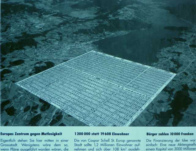
 After crossing the next bridge we're standing, right at
the arched bridge over the Autobahn, in front of a board of the "Industriepfad
Lorze". It shows the utopian (?) plans, after which right here a Mega
city should be built. See box below. In 2010 Zug, Baar, Cham, Steinhausen
had a total habitation of some 70'000.
After crossing the next bridge we're standing, right at
the arched bridge over the Autobahn, in front of a board of the "Industriepfad
Lorze". It shows the utopian (?) plans, after which right here a Mega
city should be built. See box below. In 2010 Zug, Baar, Cham, Steinhausen
had a total habitation of some 70'000.
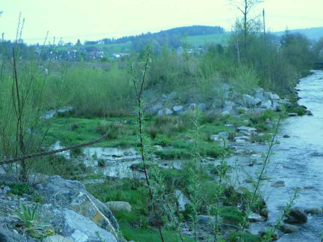
 From here to the Autobahn access the Lorze river got
more space. By the expansion, a small meadows is developing. An arm is now
meandering on the side of the main river. To the West of the Autobahn ramp
Biotopes have been built and the water of the above mentioned tube is here
flowing into the old Lorze.
From here to the Autobahn access the Lorze river got
more space. By the expansion, a small meadows is developing. An arm is now
meandering on the side of the main river. To the West of the Autobahn ramp
Biotopes have been built and the water of the above mentioned tube is here
flowing into the old Lorze.
To that original brook it's a short detour, river down to the next
bridge 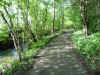 and then some 200 m to the right we're at the river walk. The path
follows the murmuring water, lined by many old trees. Actually we are
walking on the old river bed, which was divided by the new river and a new
track. At Schochenmuehle with the Garden restaurant info boards tell of the
industrialization and the mentioned electric power plant which supplied
electricity to the Neumuehle at the Baar railway station.
and then some 200 m to the right we're at the river walk. The path
follows the murmuring water, lined by many old trees. Actually we are
walking on the old river bed, which was divided by the new river and a new
track. At Schochenmuehle with the Garden restaurant info boards tell of the
industrialization and the mentioned electric power plant which supplied
electricity to the Neumuehle at the Baar railway station.
The brook still accompanies us, passing Ammansmatt where a board explains
the development of the "Bossard group". Later we reach
Kollermuehle, where again we find explanations to the "Distillery
Etter" with the "Zuger Kirsch" and the former mill. Nearby
is also the "Kollerhalle".
After the underpass under main road and railway line we reach the wooden
"Steinhausen" bridge. Soon we are near the lake. At the joinery
there is a modern toilette.
Now we proceed along the lake. On boards there are explanations about
nature and environment. Places invite for leisure, for a bath in the lake,
for a picnic.
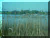 Between lake and the reed the path is heading to the gravel road
along the rail track. It's odd to think, that many years ago it was considered
of using this swampy area as a garbage dump. An area nearby is
called "Sumpf" (swamp).
Between lake and the reed the path is heading to the gravel road
along the rail track. It's odd to think, that many years ago it was considered
of using this swampy area as a garbage dump. An area nearby is
called "Sumpf" (swamp).
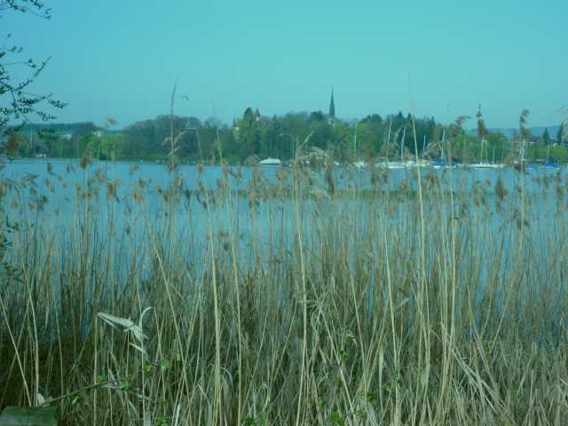
The Stadtbahn stop "Alpenblick" is probably one of the more
pleasing. Not because of the shop at the adjoining filling station, it the
beautiful view over reed, lake, to Zugersee and the Zugerberg with the
Gnipen in the background. To the Southwest Rigi Hochfluh and Rigi are
visible.
Instead of taking the train back, one may proceed to Cham and "Villette
park" (15 Min) with Restaurants, children's playground, Minigolf just
across the railway station Cham.