| |
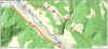
Leventina

|
Airolo-Nante-Giof-Cassin-Tremorgio-Rodi
Fiesso
Airolo-Nante-Alpe di
Ravina-Zemblasca-Pian Taioei-(Cassin)-Gioett-Ambri Sopra
Airolo-Alpe di Cristallina-AllAcqua
(Bedretto Valley) |
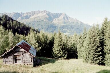
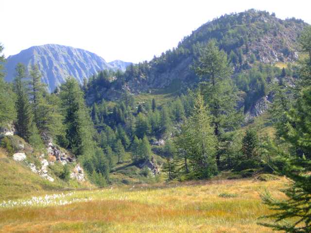
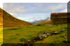
Strada alta, Strada bassa, Strada degli alpi
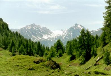
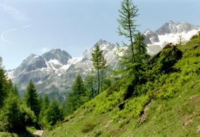
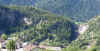
This are very popular hiking tours on the southern
side of the alps. Although it's a different world, it's only 1.5 hrs from Zug by
train. A train ride through "Gotthard" should not be missed, it's
quite an amazing train route.
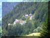
There are many lovely old little villages along
the Leventina tracks
and across the Bedretto valley (on the Nufenen Pass road).
 | Airolo-Faido (Leventina):
The comfortable route
and some alternatives. |
| Faido-Mairengo-Anzonico-Lavorgo
(Leventina):
The route in between. |
| Biasca-Lavorgo (Leventina):
My favorite
Pollegio-Sobrio-Giornico A bit shorter. |
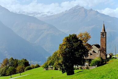
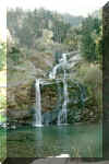
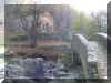
| Biasca, Petronilla chapel:
walk to the head of the waterfall across railway station. |
| Airolo-Ronco (Bedretto valley):
The "other" Strada alta. |
| Airolo-Tremorgio:
The less known route. |
| Tremorgio-Dalpe: To Pso.Vanit,
Lago Leit, Pso.di Leit, Piano di Lei, Alpe di Croslina, Piomogna,
Dalpe. |
| Rodi-Piottino
Gorge-Faido-Giornico. Visit the Gorge at Rodi and the
waterfalls at Faido, walk on the lower
track. |
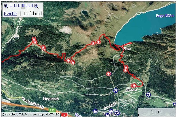
| Airolo-Lago Ritom-Lurengo:
A lovely track into a lake region on 2000 m. |
|
Piora: Hike from the Ritom-Dam to Pinett,
then along lakes Cadagno and Ritom back to the Funicular. |
| Airolo-Lucomagno: From
Leventina valley to Blenio valley, Surselva (Grison) |
|
Top of page
Strada alta
The
whole route is often split into three parts, e.g. Airolo-Osco (5 hrs),
then
Osco-Anzonico (3.5 hrs) and finally
Anzonico-Biasca (5 hrs).
Result is reasonable distances and some time for a break and/or a visit in
one of the Restaurants along the way.
In
addition to the “classical” “Strada alta”, many more attractive hiking path are on hand.
| Airolo-Faido (Leventina) |
km |
Std. |
| Zug-Airolo (train) |
|
|
| Airolo-Deggio-Cato-Osco-Mairengo-Faido |
20 |
5.5 |
| Faido-Airolo (train/Bus) |
|
|
| Airolo-Zug (train) |
|
|
This
is the convenient route. From the railway station the track is more or
less flat and there are no major ups and downs until at the end with the
descent from Osco down to Faido (bus service available). An interesting
alternative is the hike to Lake Ritom.
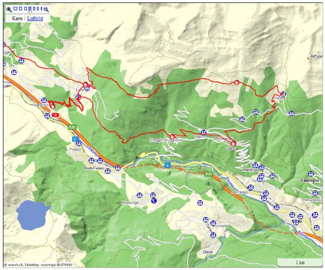
Airolo-Lurengo-(Varenzo)-Osco
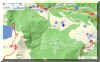
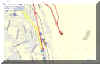
 Interactive
map: Interactive
map:
http://map.search.ch/d/ja4odc1og
GPS-routes:
GPS_Data/GPX-Lurengo-3Routen.zip
Below, the route is split into two
parts, and you’ll find the mountain tour from Osco by Predelp to
Lurengo:
| Airolo-Lurengo-Catto-Varenzo Paese |
hrs |
| Zug-Airolo (train) |
|
Airolo-Valle-Madrano-Brugnasco-Altanca-
Ronco-Deggio-Lurengo |
3.5 |
| Lurengo-Catto-Varenzo Paese |
1.0 |
| Varenzo Paese - Airolo (Bus) |
|
| Airolo-Zug (train) |
|
| Varenzo Paese-Bosco d'Öss-Freggio-Osco |
hrs |
| Zug-Airolo (train) |
|
| Airolo-Varenzo Paese (Bus) |
|
| Varenzo Paese-Catto |
1.0 |
| Catto (or Lurengo)-Bosco d'Öss-Freggio-Osco |
2.0 |
| Osco-Faido (Bus) |
|
| Faido - Zug (train) |
|
|
Osco-Predelp-Lurengo
|
hrs
|
|
Faido-Osco
(Bus)
|
|
|
Osco-Predelp
|
1.5
|
|
Predelp-Modione-Cassinella-Boscaiöu-
Cassine
di Catto-Lurengo
|
2.5
|
|
Lurengo-Piotta
Nord and
Piotta Nord-Airolo (Bus)
|
|
|
Zug-Faido
(train)
|
|
| Airolo-Zug
(train)
|
|
Postauto
schedule:
Since
just a few Bus-tours are serving the mountain villages, the schedules
should be consulted before starting the hike.
The Bus stop at Varenzo Paese
is quite lonely near the Autobahn Exit Quinto. The route “Strada
bassa” is also passing this place.
|
Airolo-Lurengo-Catto-Varenzo
Paese
Comfortably, partly on Bitumen road, without
much changes in the altitude, the road brings us to Lurengo. Sometimes a
lovely hiking track is provided, usually running near the driveway.
Outside Lurengo, a road zigzags by Catto down to Varenzo Paese. The road
is quite comfortable and not steep.
For those who’d want to proceed along the Strada alta towards Osco; they
don’t have to descend to Catto. A marker shows the road. After some 800 m
the road from Catto and Lurengo merge.
A different option is the one to the higher (1800 m) track by Cassino di
Catto, Boscaioeu, Cassinella, Predelp, to Catto, see below.
|
|
Varenzo-Catto-Osco
The second leg is on the mentioned road. From the Bus stop in Varenzo
Paese it is subtly
 ascending
to Catto, where we leave the woods. then we proceed on
the Strada alta towards Bosco d’Oess. Here we’re now on a mountain
trail, descending quite a bit into the valley and up the other side
towards Freggio. ascending
to Catto, where we leave the woods. then we proceed on
the Strada alta towards Bosco d’Oess. Here we’re now on a mountain
trail, descending quite a bit into the valley and up the other side
towards Freggio.
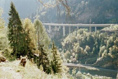
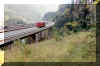
 On
the way to Freggio, enjoying the view, we may be amazed by the way the Piottino gorge was
mastered. There is the Autobahn (tunnel), railway (a system of tunnels),
the main road (tunnel), the river Ticino, the hiking track along the
river. On
the way to Freggio, enjoying the view, we may be amazed by the way the Piottino gorge was
mastered. There is the Autobahn (tunnel), railway (a system of tunnels),
the main road (tunnel), the river Ticino, the hiking track along the
river.
Of a train, entering the full circle tunnel, you can see the front and the
end at the same time.
|
|
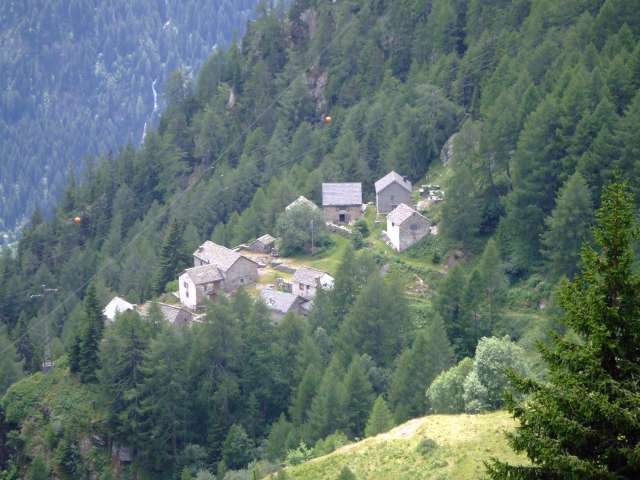
Osco-Predelp-Lurengo.
The above mentioned alternative route is a mountain trail ascending to
1800 m. Some Bus 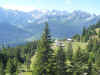 tours are serving Predelp from Faido. Predelp is an Alp
with pastures stretching out. A few Weekend homes are nestling along some
slopes. A Restaurant is inviting guests (Mondays closed (Aug
2010)). tours are serving Predelp from Faido. Predelp is an Alp
with pastures stretching out. A few Weekend homes are nestling along some
slopes. A Restaurant is inviting guests (Mondays closed (Aug
2010)).
Leaving Predelp we’re on a driveway that slowly  ascends to Modione.
There, a hiking track to the left crosses pastures and is leading into the
wooded area. It’s a narrow track and one may enjoy the flora and the
vistas into the valley and across into the Ticino mountains. ascends to Modione.
There, a hiking track to the left crosses pastures and is leading into the
wooded area. It’s a narrow track and one may enjoy the flora and the
vistas into the valley and across into the Ticino mountains.
Finally here too, a descent follows. We’re mostly in the woods in that
part of the trail. In
Lurengo a few Bus tours down to Piora Nord with connections to Airolo and
Faido are available.
|
|
Faido-Mairengo-Anzonico-Lavorgo
(Leventina) |
km |
hrs |
| Zug-Faido (train) |
|
|
| Faido-Mairengo (bus available) |
2 |
0.8 |
| Mairengo-Calpiogna-Rossura-Anzonica-Lavorgo |
15 |
4.5 |
| Lavorgo-Airolo (bus) |
|
|
| Airolo-Zug (train) |
|
|
The disadvantage of the middle section is, that you have first to climb
up to the hiking path and then descend into the valley again, although there are bus services
available. A Postauto runs between Biasca and Airolo (Bellinzona - Airolo
line). |
| Biasca-Lavorgo |
km |
hrs |
| Zug-Biasca (train) |
|
|
Biasca-Pollegio (bus)
Or walk via town center-Ponte (Bitumen) |
2 |
0.5 |
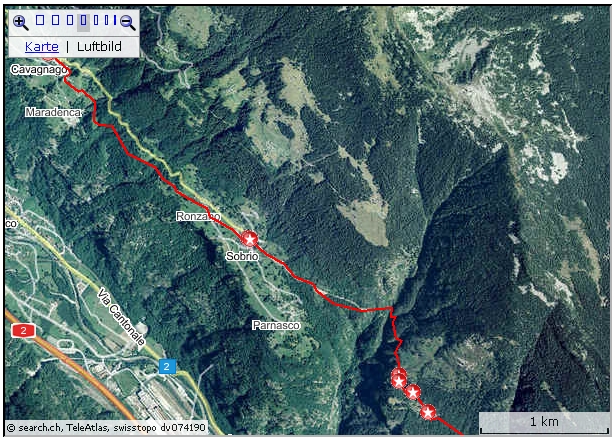
Pollegio-Corecco-Diganengo-Sobrio-
Cavagnago-Anzonico |
15 |
5.3 |
Anzonico-Lavorgo (bus)
Or walk (steep track downhill, shortcuts Bitumen road) |
2.5 |
1 |
| Lavorgo-Airolo (bus) |
|
|
| Airolo-Zug (train) |
|
|
To me, this is the most rewarding route. The hiking sign will
lead into town center (Piazza Centrale). The little town would be well
worth a visit. There, don't miss the left turn for Ponte, Pollegio. The ascent to Corecco begins right in the village center
of Pollegio, at the small resting place with the big Chestnut tree, the
creek tumbling down over the rock. The track begins with stairs and crosses lovely, shady chestnut forest, mixed with pines and some oak
trees. Having reached the height there are many beautiful views and the
northern mountain chain is always in front.
 |
 |
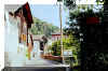
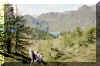
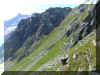
| Near Corecco |
Near Sobrio |
For the most part there are good walking
tracks well separated and hidden from the Bitumen roads connecting the
mountain hamlets.
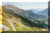
 |
 |
| Ronzano |
Entering Anzonico from Lavorgo |
For the descent from Anzonico to Lavorgo I'd rather
take the bus. Check the time table and spend the waiting time on the
terrace of one of the restaurants: some bread, Coppa, Merlot, who cares
for the time?
Biasca-Cavagnago
 Interactive
map: Interactive
map:
map.search.ch/d/2yxnzuymd
GPS-route:
GPS_Data/GPX-Biasca-Cavagnago.zip
At Bidre, with the fenced-in property a sign post at the
entrance gate points to where the mountain track continues.
 Interactive
map: Interactive
map:
http://map.search.ch/d/mmyodk0m2
GPS-route:
GPS_Data/GPX-Pollegio-Sobrio-Giornico.zip
(5 hrs) The same route as above, but after Sobrio we're following the
rather steep, but well marked track down to that village, which plaied an
important role in the early Swiss history.
At Giornico, the marker for
the Bus stop may be misleading: it points to the stop for the Postauto
heading towards Biasca (S.Antonio, at 100 m). The Bus stop for the Bus to
Faido although is to the left (100 m). |
Top of page
| Airolo-Ronco (Bedretto valley) |
km |
hrs |
| Zug-Airolo (train) |
|
|
| Airolo-Alpe Pesciuem-A.di Cristallina-A.di Vallegia-Ronco |
14 |
(2) 4 |
| Ronco-Airolo (bus) |
|
|
| Airolo-Zug (train) |
|
|
This is "the other" Strada alta called the "strada
degli alpi".
The narrow, steep hiking track starts at the cable car station. (Bus from
Railway station Airolo)
Cable car service see Website:
From Alpe di Pesciuem there is an alternative Strada alta route by way of Lago Tremorgio, finally descending to Fiesso
(Leventina).
|
To reach the cable car station and the hiking track from Airolo rail road station
follow
the main road (20 min).
You will pass the memorial for the workers who lost
their lives while working on the Gotthard train tunnel.
A second memorial is for
the ones who lost their lives while working on the Autobahn tunnel.
Underpassing the long bridge (connecting the new Gotthard-Pass road with the
Autobahn), a board remembers the 24 people who died in
the tunnel in 2001, when a accident lead to a fierce fire. |
| Top of page
This tour is a bit different: the trail will often run very close to
the Autobahn (A2/N2/E35). The noise can get a bit annoying!
| Rodi-Gola di Piottino-Faido-Giornico |
km |
Hrs |
Zug - Airolo (train)
Airolo - Rodi /Dazio Grande (Postauto) |
|
|
Dazio Grande-Gola di Piottino-Ponte di Mezzo-Ponte di
Vicchinanza-Polmengio di sopra-Faido
or
Dazio Grande-Gola di Pittino-Ponte di Mezzo-Strada Romana (Monte
Piottino passo)-Monte Piottino Domo-Mondella Ponte-Cascata
Piomogna-Faido |
|
3
3.5
|
| Faido-Nivo |
6 |
1.3 |
| Nivo-Chironico-Altirolo-Giornico |
|
2 |
Giornico - Biasca (Postauto)
Biasca - Zug (train) |
|
|
The hike begins at Dazio Grande (www.daziogrande.ch/), a former toll
station.
The old "Sust" (house providing storage rooms and services
for transporters) has been completely renovated and is housing a
Tourist center, a Museum a Restaurant with and Hotel
rooms.
(Opening hours corresponding with Museum hours)
| July, August |
open daily |
| Sept, Oct |
Mondays closed |
| Nov, Dec, Jan, Feb |
closed |
|
If you want to be sure: call, Phone Number in their
Website www.daziogrande.ch
(Aug 2005) |
Although the "old Swiss" on the Northern side of Gotthard were
fighting obstinately for freedom and independence, they found
nothing wrong in acting as Thanes over the Leventina region. (Won after
battles against the dukes of Milan)! The Dazio Grande was for some time a
source of income for Uri.
Short tour (Circuitto Piottino)
To the gorge (starting from Dazio
Grande) it's a 10 Minutes return, easy walk!
|
Dazio Grande - Dazio Vecchio - Monte Piottino Passo
(1038 m) - Lookout - Strada Romana - Ponte di Mezzo - Gola del
Piottino - Dazio Grande
(or vice versa)
90 Minutes |
Top of page
Rodi - Piottino gorge - Ponte di Mezza - Faido
See www.promedialeventina.ch
for information, maps about this attractve place.
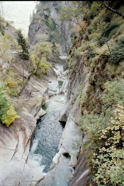
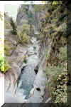 To the Ponte di Mezzo and therefore through the Gorge "Gola del
Piottino" it's hardly more then 15 Minutes. The track is excellent
and mountain boots are not required. Probably you'll add some Minutes for enjoying
the natural wonder. Fortunately there wasn't space enough, neither for
railway nor road: we meet unspoiled nature (plus a walk way). - And the
traffic noise is being drown out by the young Ticino river. To the Ponte di Mezzo and therefore through the Gorge "Gola del
Piottino" it's hardly more then 15 Minutes. The track is excellent
and mountain boots are not required. Probably you'll add some Minutes for enjoying
the natural wonder. Fortunately there wasn't space enough, neither for
railway nor road: we meet unspoiled nature (plus a walk way). - And the
traffic noise is being drown out by the young Ticino river.
At the other end of the gorge we hit Ponte di Mezzo. Now we have two alternatives, but facts for both tracks are:
Strada bassa doesn't mean flat! Additionally in fall there are
lots of fallen leaves and chestnuts that make it sometimes a bit hard to
find the track. Generally though the markings are exceptional (yellow
rhombus in black frame). The tracks are mostly narrow, stony, but marvelous
for hiking.
|  To the left, towards Mairengo - Faido by Strada bassa:
This side is much more quiet. After crossing Ticino and railway line
we're on the old Kantonssstrasse. We're crossing that road as
well. After some 30 meter to the left a narrow track is ascending up
the hill. After about 30 Minutes we're at a small stable. The track is
still going up. Soon we reach the highest point of our route. Now
chestnut are the dominating trees and pines are diminishing. Before
reaching Polmengio di sopra (755 m) on a small road, we pass four giant
chestnut trees. From here it's hardly 15 Minutes to Faido. To the left, towards Mairengo - Faido by Strada bassa:
This side is much more quiet. After crossing Ticino and railway line
we're on the old Kantonssstrasse. We're crossing that road as
well. After some 30 meter to the left a narrow track is ascending up
the hill. After about 30 Minutes we're at a small stable. The track is
still going up. Soon we reach the highest point of our route. Now
chestnut are the dominating trees and pines are diminishing. Before
reaching Polmengio di sopra (755 m) on a small road, we pass four giant
chestnut trees. From here it's hardly 15 Minutes to Faido.
|
|  To the right towards Monte Piottino passo. The track to Faido will frequently get close to-
above- or below the Autobahn: amazement for technicians, horror for nature
friends. To the right towards Monte Piottino passo. The track to Faido will frequently get close to-
above- or below the Autobahn: amazement for technicians, horror for nature
friends.
First it's a steep climb on a rocky path. After some 10 Minutes we're
at the sign "Strada Romana, 948 m". Later on we'll be
taking the road to the left (sentiero via sponda destra).
But first let's take a worthwhile detour:
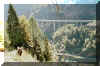
We're ascending towards the pass. After some 10 Minutes we're at a fantastic lookout. Down below and
across the valley are Entrance and Exit of a circular
railway tunnel, in between the main road and the Ticino river. But
it's not only roads and rail: atop on the mountain slopes are protections
against rock falls, avalanches. The Autobahn is beneath in a Tunnel.
-
Energetic's and/or Geology fans will extend the walk: through the
landslip area to the pass and on to Dazio Vecchia, a lovely rest area at the ruins of an old
Sust, not far from Dazio Grande.
But now back to the Strada Romana board! We choose the narrow track to
the left, along the hill slope. After some 30 Minutes we reach the
highest point of our tour: Monte Piottino Domo (1038 m).
Before we reach Faide we have again two options: a short detour to the
upper Piumogna falls with pretty lookout, or the shorter walk to the
lower falls and the little lake and park. |
Faido waterfalls - Nivo - Chironico - Giornico
 After a stop in
Faido, perhaps at the falls, you may take the
Postauto for Lavorgo. (From Lavorgo to Nivo it's about 15 Minutes). After a stop in
Faido, perhaps at the falls, you may take the
Postauto for Lavorgo. (From Lavorgo to Nivo it's about 15 Minutes).
The track from Faido is almost flat on Bitumen and runs along the
conveyor belt of the NEAT construction site. Nearby traffic on the
Autobahn is roaring by, the Ticino river not far to the right can not be
heard and it is very noisy until we've reached Nivo.
From Nivo the route is getting more interesting. The narrow track 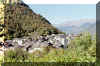 ascends until we reach the charming village Chironico with the old San
Pedrino tower. At the southern end of the village we cross the Ticinetto river, which has
dug a deep bed.
ascends until we reach the charming village Chironico with the old San
Pedrino tower. At the southern end of the village we cross the Ticinetto river, which has
dug a deep bed.
Passing the typical Ticino style church we proceed to the
chapel San Pellegrino and on to Altirolo.
Here we come upon the first vines.
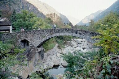
On the way down to Giornico we're walking mostly in a chestnut 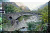 forest. Giornico
is historically significant
(It was in the 15th century, in a bloody battle here that Uri won back
Leventina and kept it until 1798). The two old churches, Museums and the bow
bridges crossing
the Ticino river may give some ideas for closer inspections. forest. Giornico
is historically significant
(It was in the 15th century, in a bloody battle here that Uri won back
Leventina and kept it until 1798). The two old churches, Museums and the bow
bridges crossing
the Ticino river may give some ideas for closer inspections.
|
| Top of page
Val Piora with its lakes rests on 2000 m. The Lago Ritom is a dammed
lake. From Piotta the worlds steepest funicular is connecting the area.
| Airolo-Lago Ritom-Lurengo |
km |
hrs |
| Zug - Airolo (train) |
|
|
Airolo-Valle-Madrano-Buco di Ce-Ce di Fuori-(Pian Toei)-
Bochetta di Foeise-Lago Ritom
Lago Ritom-Paso Forca-Camin di Deggio-di Quinto-di Cato-
Sopra Lurengo-Lurengo |
6
4 |
4
3 |
Lurengo - Piotta (bus)
Piotta - Airolo (Postauto)
Airolo - Zug (train) |
|
|
For the main part of this trail a pleasant track is leading up to the alp on
1900 m. Reaching the fork shortly after entering the forest track we'll proceed
on the left (eastern) part. The path is running on the side of the Val Canaria
valley.
 At Buco di
Ce, high up with undisturbed view over Airolo we come across some
houses and an alp hut. At Buco di
Ce, high up with undisturbed view over Airolo we come across some
houses and an alp hut.
We're proceeding towards Pian Toei. Instead of choosing the more comfortable
route to the upper station of the funicular Ambri-Piora we turn left for the
slope of the Foeisc mountain.
 Where tracks are not visible, sticks with the typical white/red/white
marks are provided for a general direction up the crest. There finally we're rewarded with a superb view over lake Ritom below. In
the distance another lake, Lago di Tom can be seen. Where tracks are not visible, sticks with the typical white/red/white
marks are provided for a general direction up the crest. There finally we're rewarded with a superb view over lake Ritom below. In
the distance another lake, Lago di Tom can be seen. After the short descent to
the dam we continue the trail for Lurengo.
 |
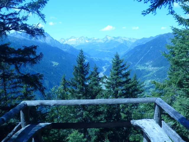
View back to the crossing above Lago Ritom. |
 First there is another climb to the Paso Forca on 2235 m. From there it's a steady
descent on a good track until Lurengo.
First there is another climb to the Paso Forca on 2235 m. From there it's a steady
descent on a good track until Lurengo.
From Lurengo we catch the small bus that connects the little mountain villages between
Lurengo and Altanca with Piotta.
Alternative: From Lago Ritom, along the
eastern shore by Cadagno, Alpe Piora Passo dell'Uomo to Passo Lucomagno,
or Lukmanier (3
hrs). From there by Postauto to Biasca (train station). Check time table before
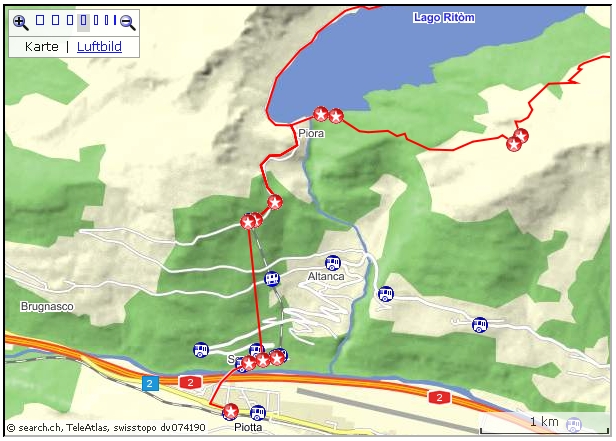
you start: Postauto service only during summer! Piora-Altanca
 Active
map Airolo-Piora-Altanca: Active
map Airolo-Piora-Altanca:
http://map.search.ch/d/taxotiyng
GPS-route:
GPS_Data/GPX-Airolo-Ritom-Altanca.zip
 (50
Min). Most of the hikers will choose the funicular to Piotta for the
descent. Although there is an old mule track to Altanca, passing Valle
di sopra. The track is laid out typically with stones and its a very
impressive hike down the right side of the gorge. The hamlet Valle seems
to be unreal on the steep shoulder. (50
Min). Most of the hikers will choose the funicular to Piotta for the
descent. Although there is an old mule track to Altanca, passing Valle
di sopra. The track is laid out typically with stones and its a very
impressive hike down the right side of the gorge. The hamlet Valle seems
to be unreal on the steep shoulder.
 In
Altanca there is Postauto connection to Piotta. Two Restaurants make
waiting a welcome sport. In
Altanca there is Postauto connection to Piotta. Two Restaurants make
waiting a welcome sport.
As an alternative, walk to the half-way stop of the funicular for Piotta
(10 Min).
Top of page
Here a shorter hike in the Lago Ritom region.
active
map:
http://map.search.ch/d/2zmm2vkmg
GPX-route:
GPS_Data/GPX-Piora.zip
| Piora |
hrs |
| Zug-Airolo (SBB) |
|
Airolo-Piotta Funicolare (Postauto towards
Dalpe)
or Airolo-Piotta Nord (Postauto towards Bellinzona) plus 15 Minutes walk to the
Funicolare |
|
End station of Funicular-Dam-Pinett-Lago Cadagno-Lago Ritom-Dam-Funicular
Extension:
At Cadagno up towards Cadlimo Hut, then to Lago di Tom and down to Lago
Ritom |
4
+0.5 |
Piotta funicolare (Postauto towards Airolo)-Airolo
or 15 Minutes walk to Bus stop Piotta Nord |
|
| Airolo-Zug (SBB) |
|
The Funicolare del Ritom is in operation
between May and October.
www.ritom.ch
From the Railway station the "Centrale", the power station with
the steep little train, is (at times) served directly by Postauto (5
Minutes). If not, the walk from the normal Bus stop "Piotta
Nord" on the main road Faido-Airolo takes about 15 Minutes. From
the station at the top, the walk along the Bitumen road up to 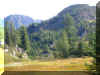 the Dam is
about 25 Minutes. Then across the Dam towards the Restaurant. The track
there heads upwards through bush and Larch pines. It's a lovely mountain
trail, with stone-paved patches in some places. A quiet and peaceful hike, not
too steep. the Dam is
about 25 Minutes. Then across the Dam towards the Restaurant. The track
there heads upwards through bush and Larch pines. It's a lovely mountain
trail, with stone-paved patches in some places. A quiet and peaceful hike, not
too steep. 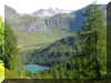 At Pinett the trail to the right would lead towards
Lurengo, as mentioned above. The highest pint of about 2070 m is almost reached.
The track to the left leads to Cadagno. Below, part of Lago Ritom is glinting,
the much smaller Lago Cadagno some way up. At Pinett the trail to the right would lead towards
Lurengo, as mentioned above. The highest pint of about 2070 m is almost reached.
The track to the left leads to Cadagno. Below, part of Lago Ritom is glinting,
the much smaller Lago Cadagno some way up.
To the hut Cadagno or the Lake, the track is over grass land. Before
hitting the road to the Hut, the bow bridge over river Murinascia has to be crossed.
After circumventing Lago Cadagno and reaching the Restaurant, a track
towards Cadlimo hut offers a detour to Lago di Tom. If there are too many
cars driving along Lake Ritom, the plus 30 Minute's detour is the better
choice then walking along the gravel road.
Because mainly of connections with public transport I chose the reverse
direction, Lucomagno (Lukmanier) to Airolo.
| Lucomagno - Piora - Airolo |
hrs |
Zug-Biasca (train)
Biasca-Lucomagno (Bus, Postauto) |
|
| Lucomagno-Val Termine-Pso dell'Uomo-Segna-Val
Piora-Alpe di Piora-Croce-Cadagna di Fuori-Laghetto-Bocchetta di
Foeisc-Pian Toei-Buco di Ce-Ce di Fuori-Madrano-Valle-Airolo |
7 |
| Airolo-Zug (train) |
|
Postauto: check! usually only in operation during
Summer months!
Passing along the picturesque Blenio valley we're welcomed by a couple
of small charming Ticino hamlets. In the small town Olivone a larger group
of vacationers are joining the green Bus of the "Auto Bleinesi". Arriving
the summit with Hotel/Restaurant we're at the opening to the Grison (Graubuenden) region with Val
Medel. If you listen carefully, you'll recognize that locals
among themselves speak neither Italian nor German: it's the fourth
official language in Switzerland, Rumantsch. The trail begins right at
the Hotel, down to the lake (Lai da Sontga Maria) and for a short while along the western shore.
Then a rocky road is leading upwards in a steady pace.
After some 30 Minutes the turnoff for a alternative route to Piora is
 reached: the one by Cadlimo hut (+ 2 hrs).
Our route is straight on, and after another 40 Minutes we're at the Summit:
Passo dell'Uomo on 2200 m. 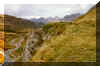 We're now
entering the Piora valley and soon we're following the rim of a deep
gorge. In the proximity of Cadagno hut, Lake Cadagno and dwellings on Alpe
di Piora are inviting. Here the trail to Paso Forca offers another
alternative: a descent to Lurengo (see Airolo-Lago
Ritom-Lurengo). We're now
entering the Piora valley and soon we're following the rim of a deep
gorge. In the proximity of Cadagno hut, Lake Cadagno and dwellings on Alpe
di Piora are inviting. Here the trail to Paso Forca offers another
alternative: a descent to Lurengo (see Airolo-Lago
Ritom-Lurengo).
Passing that lake we proceed down to Lago Ritom. On a gravel road along
the shore the dam and Hotel/Restaurant Piora can be reached.
From the
dam its about 25 Minutes to the funicular to Piotta (and from there by Bus
to Airolo).
 For the more ambitious: Just before getting to the dam, a small steep
track to the right is ascending to Foeisc.
For the more ambitious: Just before getting to the dam, a small steep
track to the right is ascending to Foeisc.
It's the same lovely route mentioned above in the first part of the route Airolo-Lago
Ritom-Lurengo. The climb is up to the altitude of about 2100 m, the
descent to Airolo (1000 m lower) is for the last part on a fairly steep
forest track.
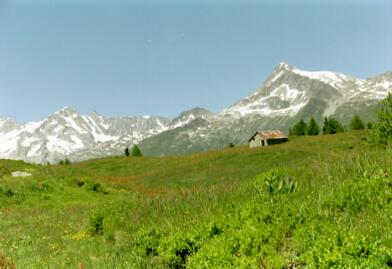
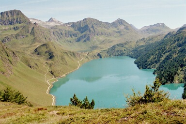
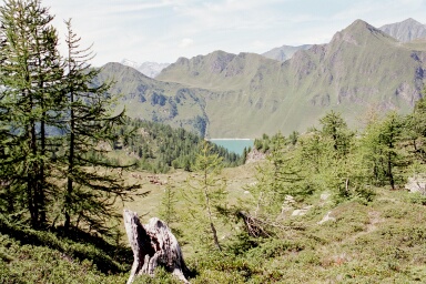
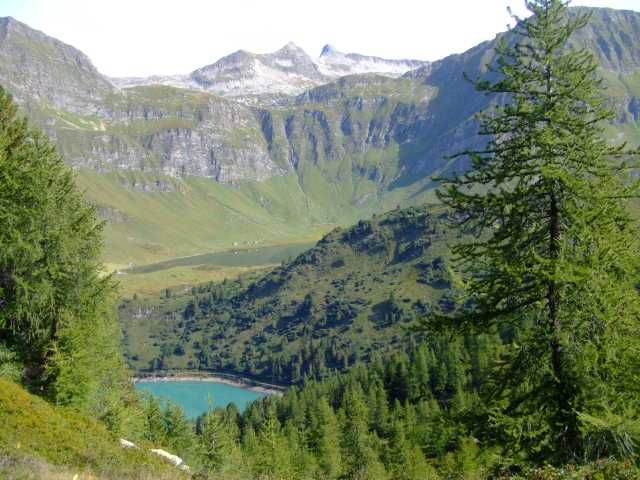
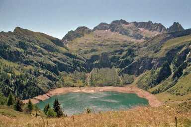
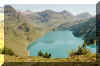
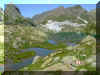
Lago Tremorgio on 1830 m is a pretty (dammed) lake surrounded by
mountains. Thanks to the use of the water, during summer cable car and
Restaurant are open to the public.
Info cable car Tremorgio, Restaurant (it):
www.capannatremorgio.ch/
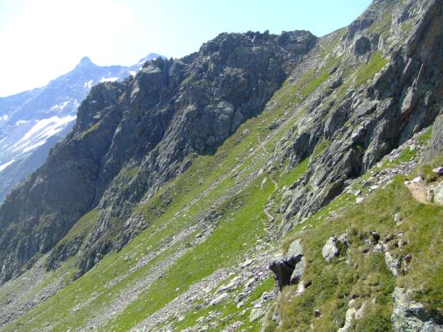
| Airolo-Tremorgio-Rodi, lower route |
hrs |
| Zug-Airolo (train) |
|
Airolo-Nante-Giof-Cassin-Pian Mott-Lago Tremorgio
Tremorgio-Rodi
(option: cable car Tremorgio-Rodi) |
5.5
1.75
0.3 |
Rodi (Posta) -Airolo (Postauto)
Airolo-Zug (train) |
|
The first part of this tour is the same as for the Bedretto
valley. In a wide circle we reach the cable car station to Alpe Pesciuem.
The cable car service is discontinued during the summer term. In the
winter it will bring the skiers into the ski arena. When the grass
is high, the track zigzagging up to Nante is not always clearly visible,
although there are frequently marks on trees and other suitable posts. In
Nante the Tremorgio track then turns off to the left. For a longer part, the
road will now be almost flat.
Option: there is a higher track running from Alpe Pesciuem by Alpe di Ravina to
the crossings near Cassin. 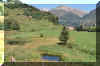 Having passed Nante there are
two tracks to choose: I picked the left one (for some parts a Bitumen
road). Having passed Nante there are
two tracks to choose: I picked the left one (for some parts a Bitumen
road).
The other, a hiking path, would carry over a hill towards Alpe
di Ravina and merge again near the river Calcascia.
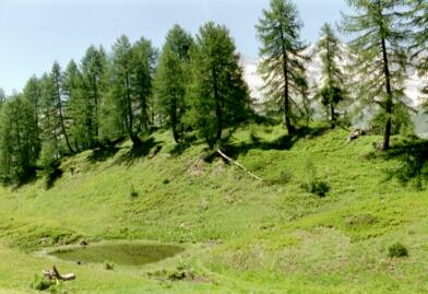
On the rather flat road we're passing a small marsh with a little
lake.
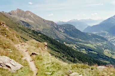
Leaving the little hamlet Giof the road is ascending and after
Pian Mott we're on the "real" ascent to the highest point of the
tour, "altitude 2040 m". There, we're rewarded with a fantastic vista. During
the tour, we've crossed quiet alpine meadows, then walked 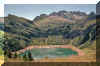 along steep
rock walls. Sometimes we got a view into the Leventina valley where the
noise is penetrating our peaceful world. The road is also
a service road for securing the safety of the traffic lines deep below
against slides and falling rocks. A more direct contrast is given by the
tour Piottino gorge to Faido. along steep
rock walls. Sometimes we got a view into the Leventina valley where the
noise is penetrating our peaceful world. The road is also
a service road for securing the safety of the traffic lines deep below
against slides and falling rocks. A more direct contrast is given by the
tour Piottino gorge to Faido. To
the lake and the Alp it's a 20 Minutes descent passing alpine flora. For
Rodi-Fiesso there is a "short cut" by cable car. It seems, most
of the hikers prefer the cable car ride; although the
track is well kept and for the most part the trees provide lovely
shadow.
As an additional option, after some 1000 m down the track there is a turnoff for
Mascengo, Prato and consequently on to Rodi or the Dazio Grande (all have
bus stops). If you're
too early in Rodi (and don't care for the nearby Restaurants), walk the 15
Minutes South to the Dazio Grande Museo/Ristorante and the
nearby Piottino gorge. Upper
Route
| Airolo-Tremorgio-Rodi |
hrs |
| Zug-Airolo (train) |
|
Airolo-Nante-Alpe di Ravina-Zemblasca-
Pian Taioei-(Cassin)-Gioett-Ambri Sopra
Higher Route (Nante-Cassin) to Tremorgio tour |
5.5 |
Ambri (Posta) -Airolo (Postauto)
Airolo-Zug (train) |
|
This track may be used as an alternative route between Nante
and Cassin. Although it's a detour with a climb to the Alpe di Ravina
and a descent down to Cassin and the lower Tremorgio route (about 400 m up
and down, perhaps plus 1 hr): the track is lovely and for a good part a footpath, crossing
tranquil alpine vegetation. The first part is exactly the same as
mentioned in the above notes.
From Nante the ascent continues: not really steep but steady. Having
reached the ski area on Ravina the track runs on more or less the same
altitude, across meadows, blueberry shrubs, light Larch-forest. It's a
lovely, very quiet area. After Zemblasca a road leads down into the vicinity
of Cassin, where we hit the lower route.
 Active
map: Active
map:
http://map.search.ch/d/mvlowe1nj
GPS-route:
GPS_Data/GPX-Tremorgio-Dalpe.zip
6 hrs.
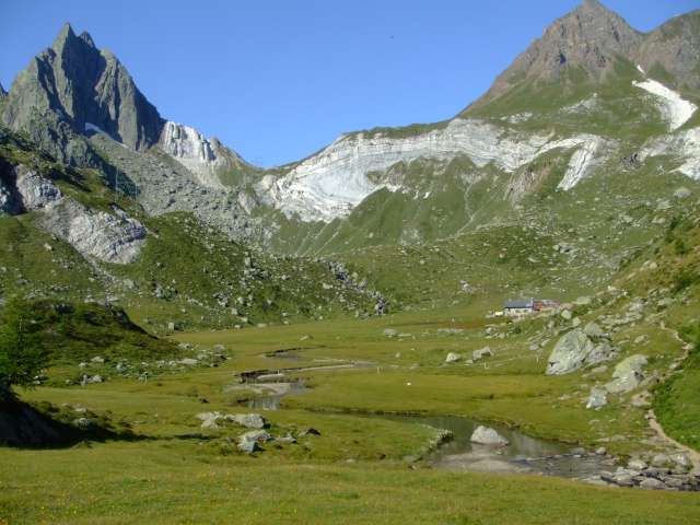
Lago Tremorgio - Alpe Camp0lungo - Passo Vanit - Cap.Leit -
Pt.2431 - Alpe Lei di Cima - Cap.Campo Tencia - Alpe di Croslina - Sgnoi -
Piumogna - Dalpe.
From Postauto stop "Rodi Posta" it's a short walk to the power
plant. There, on the
left side, a walking track leads to the small cable car station that is
somewhat hidden behind the power station. On top, passing the
Restaurant, the track is heading to the left and it's all the time uphill.
There are many pretty sights down to the lake and over to the surrounding mountain
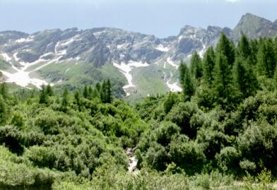
chain. 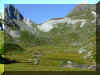 At Alpe Campolungo white sandy patches attract the view. Across on the
mountain walls, white areas show gypsum, not snow. - That type of material has
been causing a lot of thinking for the Engineers who were planning the new
train tunnel (NEAT). The area called "Piotta Mulde" (trough) had to be detoured,
because the tons of fine white sand would have been a huge problem. As of
Aug 2009 over 90% of the whole tunnel system is now cut and the problem
zone had not been touched and is out of the way.
At Alpe Campolungo white sandy patches attract the view. Across on the
mountain walls, white areas show gypsum, not snow. - That type of material has
been causing a lot of thinking for the Engineers who were planning the new
train tunnel (NEAT). The area called "Piotta Mulde" (trough) had to be detoured,
because the tons of fine white sand would have been a huge problem. As of
Aug 2009 over 90% of the whole tunnel system is now cut and the problem
zone had not been touched and is out of the way.
 After
a short climb we're at Passo Vanit, with a first view into Leventina
valley. Proceeding along the track above the alpine valley we reach the
ascent to the "capana di Leit SAT", a welcome stop. After
a short climb we're at Passo Vanit, with a first view into Leventina
valley. Proceeding along the track above the alpine valley we reach the
ascent to the "capana di Leit SAT", a welcome stop.
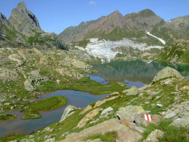
 The
next part is first along the little lake. The track is ascending to the
point 2431, with a marvelous view. The passage across to Lei di Cima is
perhaps not to everybody's liking. We walk along a sheer drop, although
the track itself is no problem. The
next part is first along the little lake. The track is ascending to the
point 2431, with a marvelous view. The passage across to Lei di Cima is
perhaps not to everybody's liking. We walk along a sheer drop, although
the track itself is no problem.
Finally we're reaching the "cap.
Campo Tencia". A wide view into the valley tells about the stretch to
be done down to Dalpe. The tour is often done as a two day hike.
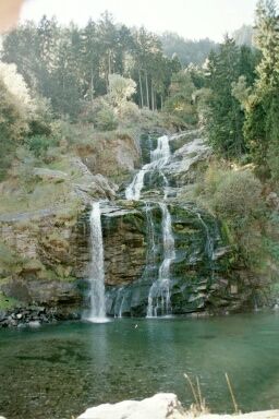
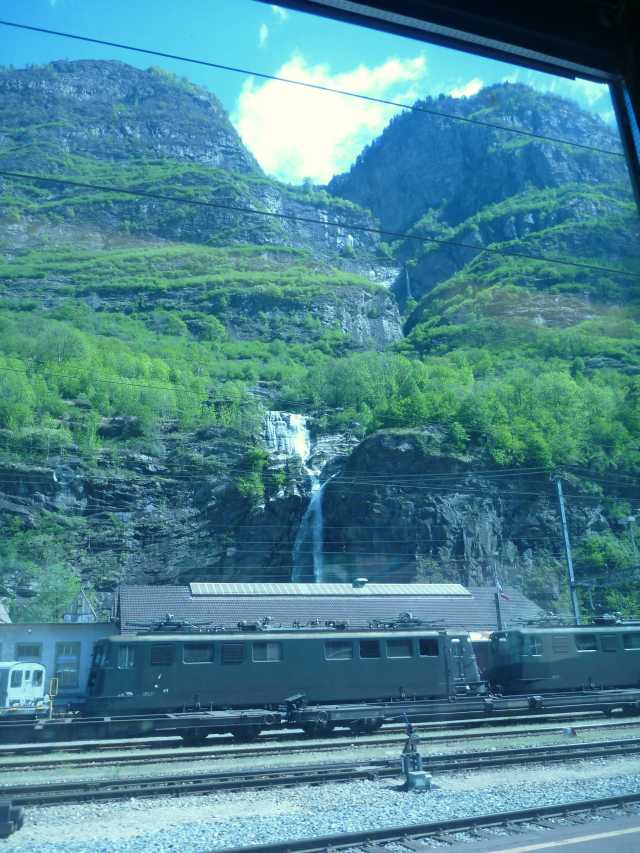
Biasca
 Directly at the Railway station
Biasca a waterfall is tumbling down. When the
Chestnut trees have lost their leaves, the little chapel is visible too.
The chapel is devoted to Santa Petronilla, the patroness of the city of
Rom. The short walk up there is worthwhile (1.5 hrs return). Directly at the Railway station
Biasca a waterfall is tumbling down. When the
Chestnut trees have lost their leaves, the little chapel is visible too.
The chapel is devoted to Santa Petronilla, the patroness of the city of
Rom. The short walk up there is worthwhile (1.5 hrs return).
 Interactive
map: Interactive
map:
map.search.ch/d/zhimzbiyj
GPS-Route:
GPS_Data/GPX-Biasca-Petronilla.zip
The first part is along the Railway line (along Via
Giovanni), then through the under crossing to the small square, where
Via Nadro turns off to the right. After some 100 m we hit Via Sta.
Petronilla, a cobblestone road just wide enough for a car.
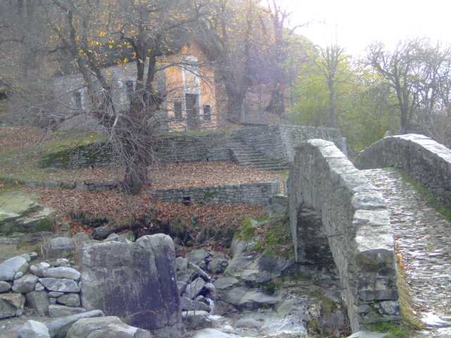
After the short ascent, the street continues over the bow bridge and over the
waterfall.
 We've
reached a little paradise. We're high over Biasca, and to the left a
second waterfall is tumbling down. Here the river Froda has become
tranquil and there are small pools with cold water. A lovely place for a
rest. We've
reached a little paradise. We're high over Biasca, and to the left a
second waterfall is tumbling down. Here the river Froda has become
tranquil and there are small pools with cold water. A lovely place for a
rest.
Across, the Petronilla chapel is attracting the view, beautifully
surrounded by 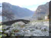 Chestnut
trees. Already in the 11th Cent. a chapel seems to have been there. Somewhat
behind the building, some Ruins are recognizable. - Probably remainders of
the
former "castello degli Orelli", the then Residents of Biasca. Chestnut
trees. Already in the 11th Cent. a chapel seems to have been there. Somewhat
behind the building, some Ruins are recognizable. - Probably remainders of
the
former "castello degli Orelli", the then Residents of Biasca.
Biasca, some history
Biasca, the
center of the "Tre Valli" (Leventina, Blenio, Riviera) has
experienced a mixed history, and there are some tight connections with the old
founder Cantons of Central Switzerland, and with Zug.
Between Uri and the
Ticino existed good relations. Most interesting though was business: the Milano
and the Lombardy market. Comparable with the "old Swiss", the Tre
vally people wanted some Freedom and autonomy too. - And it was granted them. The two
Valleys Blenio and Leventina cooperated in military and political matters.
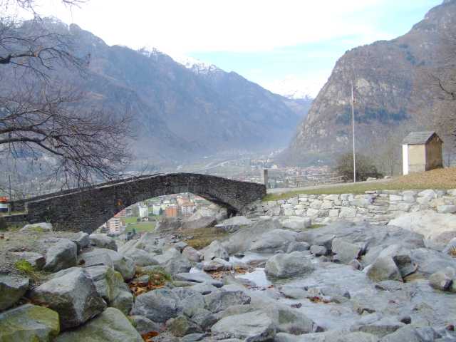
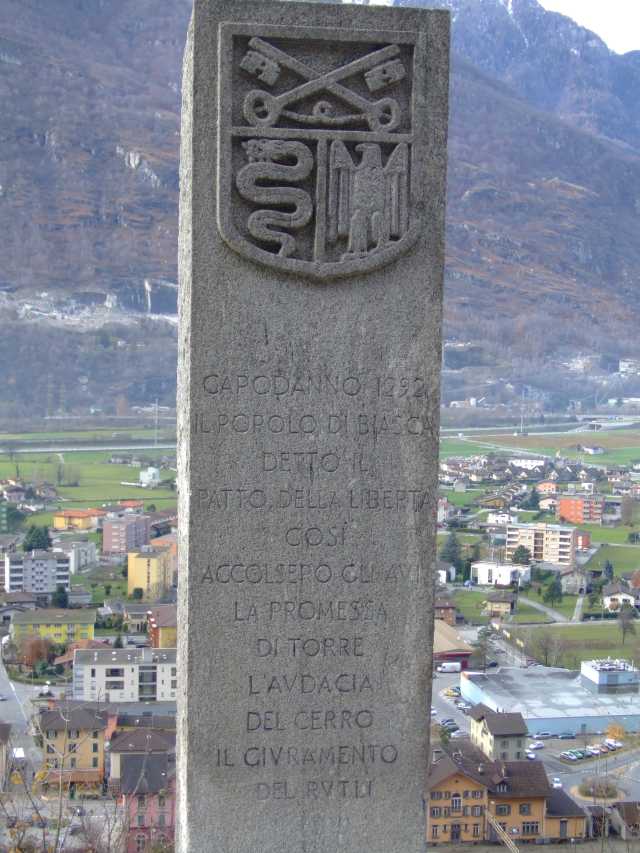
 The
memorial stone in front of the bridge refers to the Year 1292, when Biasca
was granted the right to elect the worldly Regent (Podestat). The region
belonged to the Bishop of Milano (a 984 heirloom from Bishop Atto of
Vercelli), until 1888. The administration was left until 14th Cent. in the
hands of the Orello family, later in the hands of the visconti's of Milano. The
memorial stone in front of the bridge refers to the Year 1292, when Biasca
was granted the right to elect the worldly Regent (Podestat). The region
belonged to the Bishop of Milano (a 984 heirloom from Bishop Atto of
Vercelli), until 1888. The administration was left until 14th Cent. in the
hands of the Orello family, later in the hands of the visconti's of Milano.
Uri was very interested into owning the Leventina and 1403 they
conquered the Valley, to the delight of the Biasca people. But then they
were considered inferiors and the Swiss were acting as bosses: the Swiss
considered themselves conquerors and not liberators. Although hardly 20
years later, in the battle of Arbedo (just north of Bellinzona), the area was lost again and  in
the Peace of Milano they had to return Biasca and the Blenio valley to the
Italians. in
the Peace of Milano they had to return Biasca and the Blenio valley to the
Italians.
In that battle the Standard bearer Peter, Rudolf and Johann Kolin from Zug lost their life. Painted
on the wall of the Rathaus in Zug this moment is documented: the Standard
is being saved by Johann Landtwing.
In
the winter 1478 some 10'000 Swiss marched towards Bellinzona. The mayor of
the town of Zuerich, Hans Waldmann, born in Baar was one of the leaders.
After the retreat to Giornico (10 km N of Biasca) the Swiss were able to defeat the Milano force. As
usual in those days, on both sides were Swiss mercenaries. 1480 Leventina
was back in the hands of the Swiss, 1501 Blenio Valley and Riviera Valley
were added.
From
1516 until 1798 (Napoleon) Biasca was Uri's "Vogtei" (kind of
colony) with administration in Osogna.
Biasca was able to profit from the opening of the Gotthard-route.
1512 a huge landslide off Monte Crenone destroyed the
area. River Brenno was blocked by the rubble and a year later the dam broke and the area
all the way down to Bellinzona was flooded. "Buzzo die Biasca"
is the remaining debris of the landslide.
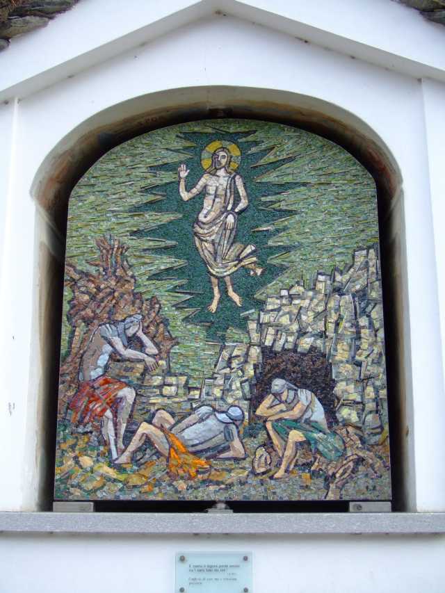
Station of the
Cross, old Church
From the Petronilla chapel back to the memorial stone. Instead of 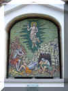 the
cobblestone
road we're now on the path to the right, following the Stations of the
Cross. Built in 1998 the modern designs are built with Mosaic stone of
different colors and material. On a Plexiglas board a reference to
biblical text and contemporary thoughts are given. the
cobblestone
road we're now on the path to the right, following the Stations of the
Cross. Built in 1998 the modern designs are built with Mosaic stone of
different colors and material. On a Plexiglas board a reference to
biblical text and contemporary thoughts are given.
The track takes us to the old church "Santi Pietro e 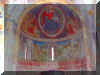 Paolo".
The church is a couple of hundred years old: the pictures inside are from
12th to 17th Cent. and are among the oldest in the Ticino. Renovations are
still going on (2008). Paolo".
The church is a couple of hundred years old: the pictures inside are from
12th to 17th Cent. and are among the oldest in the Ticino. Renovations are
still going on (2008).
Outside the church is the old cemetery: beautifully situated with a
superb view.
From the church two roads head down toward the modern church "San
Carlo". |
|